729-foot Amicalola Falls is famous for being the highest waterfall in Georgia. Nestled in Amicalola Falls State Park, the falls attracts a crowd of tourists all throughout the year. A network of hiking trails and pathways is positioned around the falls and both to the west and east of it. For those seeking a more intimidating hike that relatively has some solitude, the park has two trails that head out into nearby Chattahoochee National Forest. The Hike Inn Trail leads to a lodge that is accessible only by foot five miles from the park, while the AT Approach Trail acts as the access trail to Springer Mountain - the southern terminus of the Appalachian Trail. You'll be treated to continuous winter views and several year-round viewpoints on both trails. This hike occurred on Saturday, March 4, 2016. My plan was to take the AT Approach Trail from the Visitor Center past Amicalola Falls and to the Hike Inn parking area and trailhead. From there, I would take the Hike Inn Trail to the Len Foote Hike Inn and then to the AT Approach Trail near Amicalola Mountain. Then, I would take the AT Approach Trail to Springer Mountain. I would return to the Hike Inn Trailhead using solely the AT Approach Trail. From the Hike In Trailhead, I would take East Ridge Trail to the Visitor Center.
Summary
R/T Length of Trail: 19.7 Miles
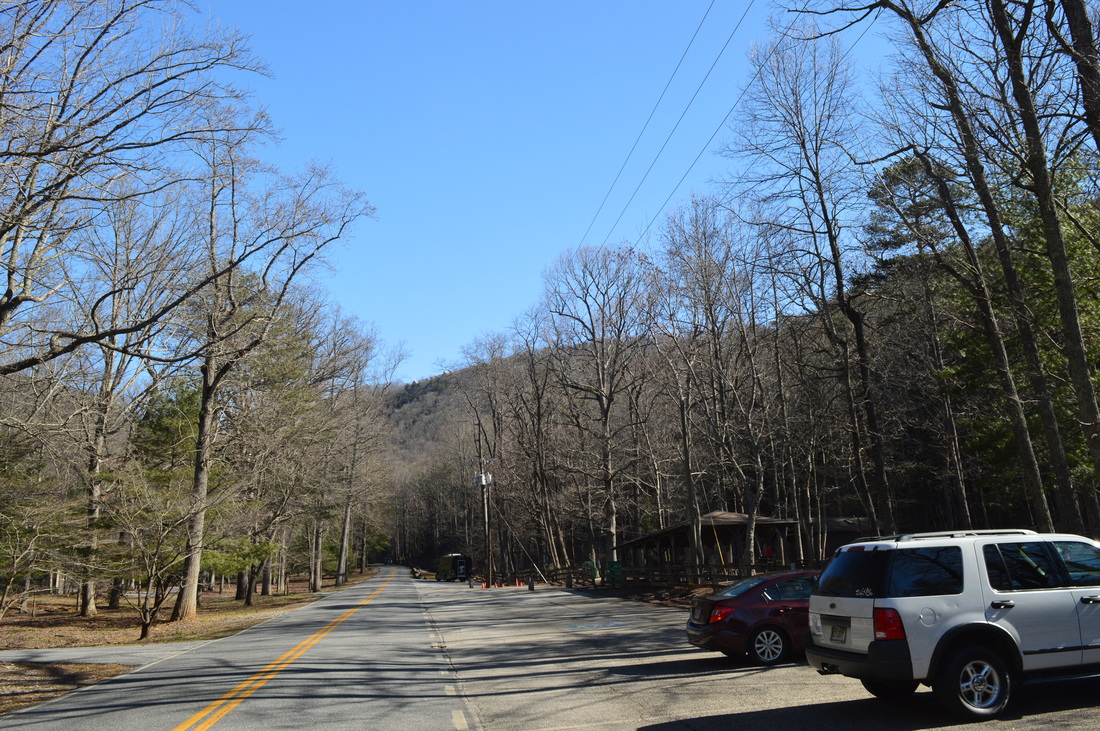
Duration of Hike: 12:30 Type of Hike: Double Loop Difficulty Rating: 9 out of 10 Total Elevation Gain: 4730 Feet Pros: Most of the hike is on easy-to-follow trails that do not require navigational skills Cons: There are many ascents on this hike, and many mountains are encountered; the last section of the hike along the East Ridge Trail is often steep and rough Points of Interest: Amicalola Falls - 9 stars; Vistas on Hike Inn Trail - 2 stars; Springer Mountain Vista - 3 stars; Len Foote Hike Inn Trail Blaze Color(s): AT Approach Trail - Blue; Hike Inn Trail - Lime Green; East Ridge Trail - None Best Season(s) to Hike: Year-round, views are better in winter Fees: There is a $5 parking fee at Amicalola Falls State Park. Pay at the booth near the entrance. Beginning Point: Amicalola Falls State Park Visitor Center Directions: From Dawsonville, GA: Follow GA State Route 53 West for 2.5 miles. Then, bear right onto GA State Route 183. Follow it for 10.4 miles, and then, bear right onto GA State Route 52. In another 1.5 miles, turn left onto the entrance road for Amicalola Falls State Park and enter the park. Continue for 0.3 miles to the Visitor Center and the large parking area near it - this is where the hike begins. Map
Click here for more information and to download this trail map to view in Garmin Basecamp.
Details
Most people have heard about Amicalola Falls State Park. Most people know that the park is home to tha tallest waterfall in Georgia: Amicalola Falls. However, most people don't know about the two other trails that leave the park. Together, the Appalachian Approach Trail and Hike Inn Trail can be combined for a very strenuous hike across several mountains, including Frosty Mountain, Black Mountain, and Springer Mountain, as well as stops at Amicalola Falls and the Len Foote Hike Inn. I wanted to hike the AT Approach Trail for over a year, but I just never got around to it until now. Honestly, I did not expect so much elevation gain on this hike, and as a result, it took me over 12 hours to complete the hike - significantly longer than I had counted on.
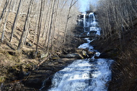
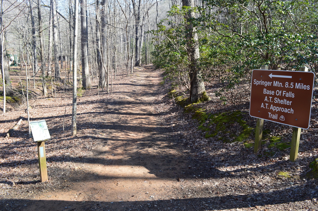
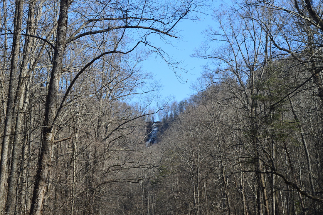
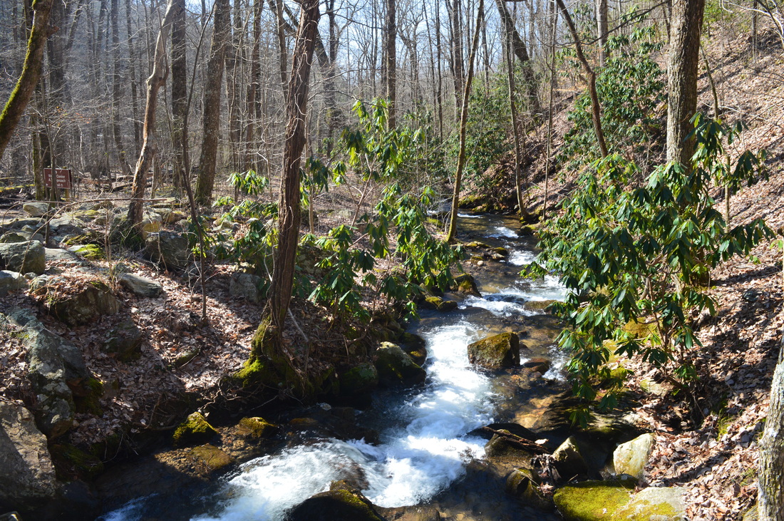
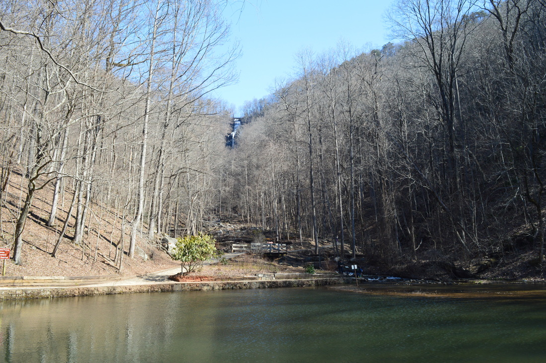
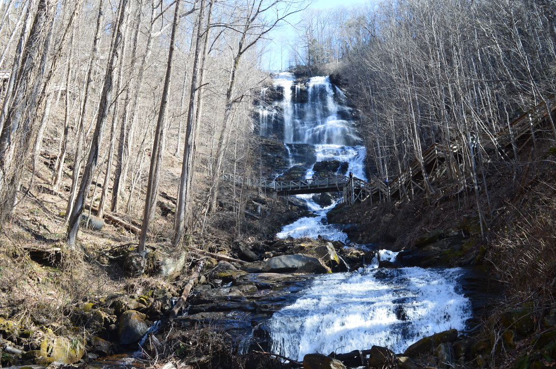
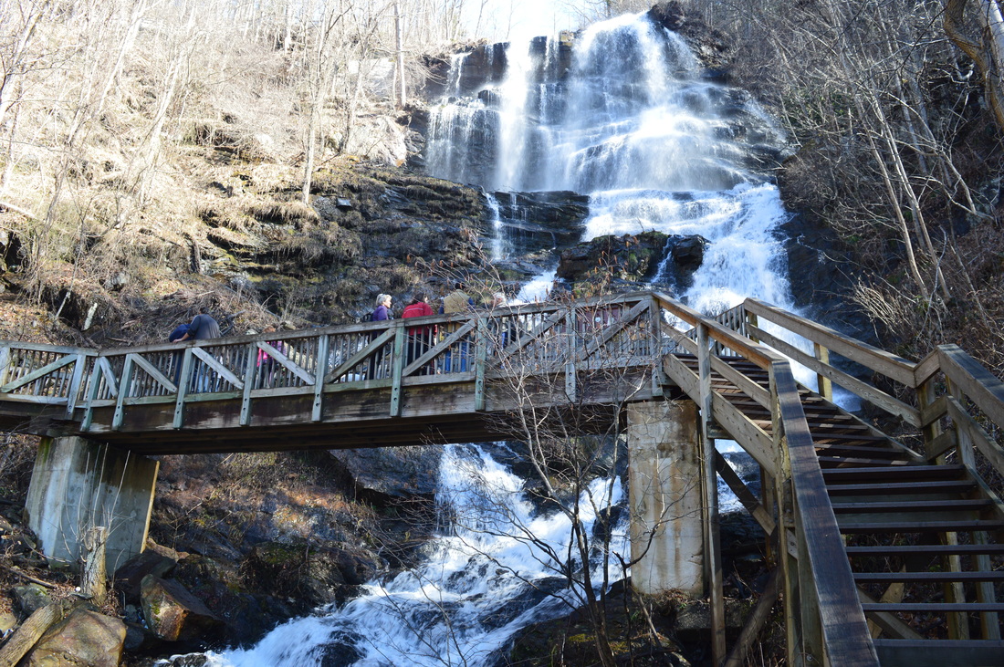
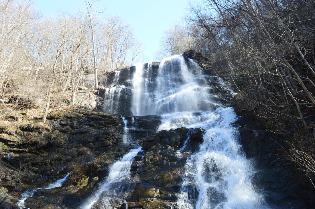
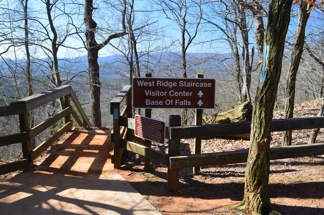
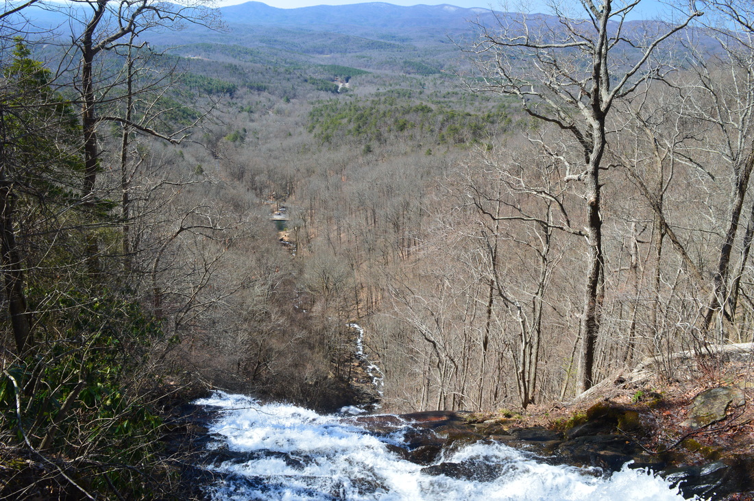
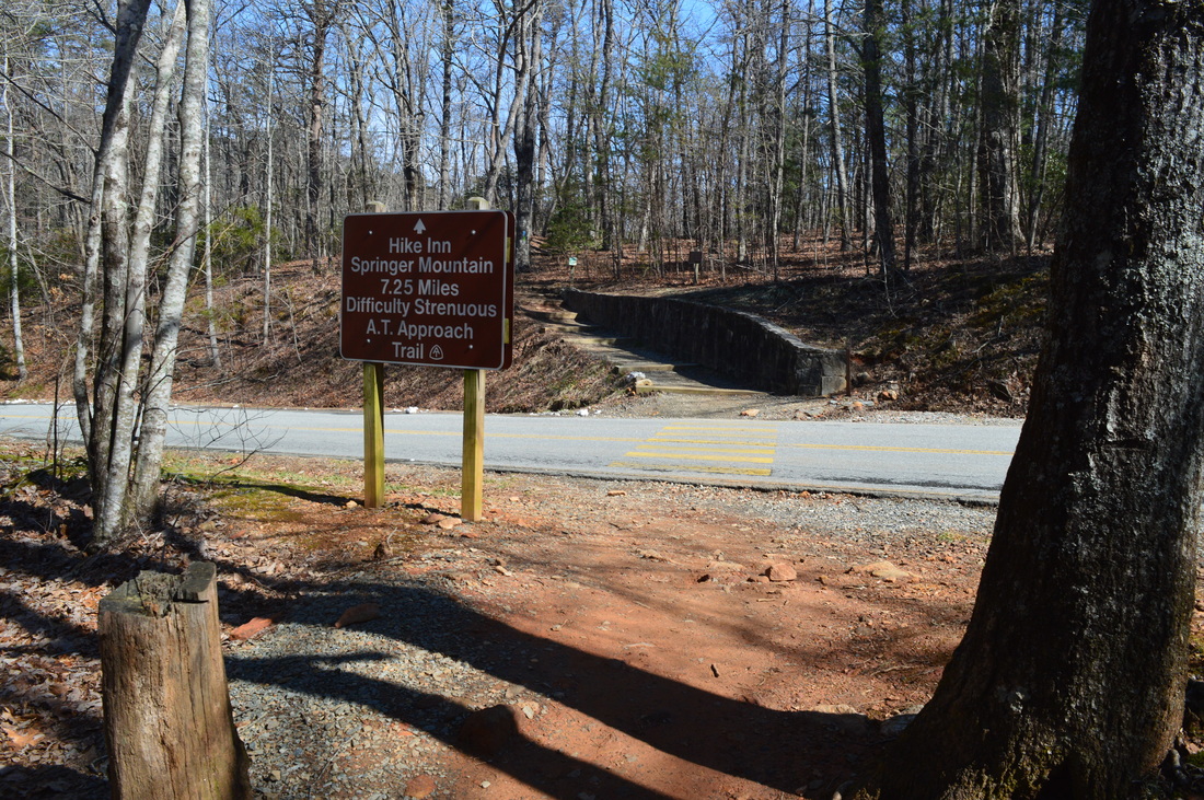
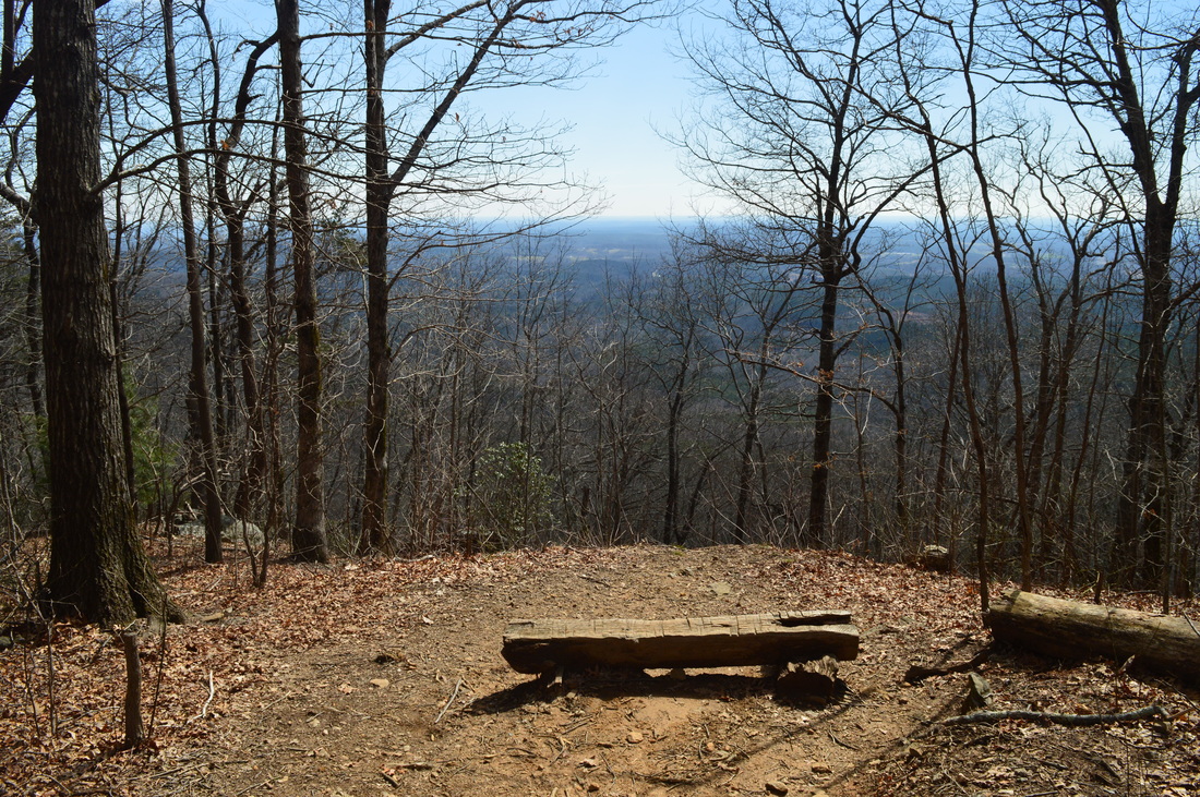
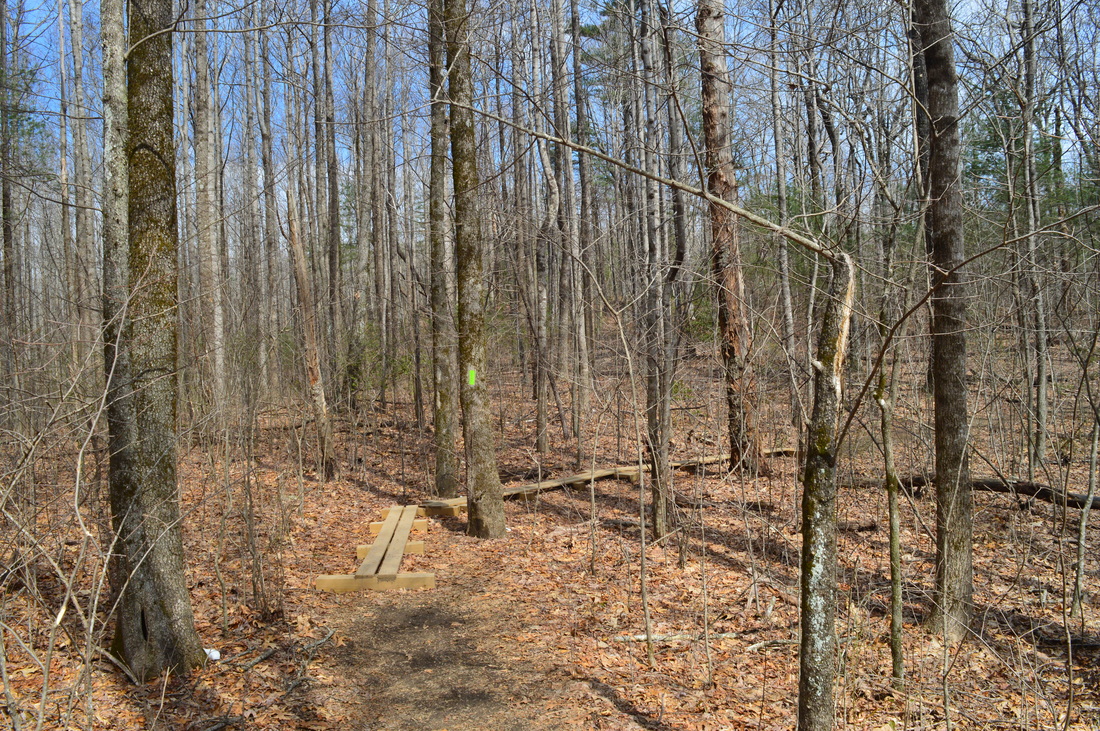
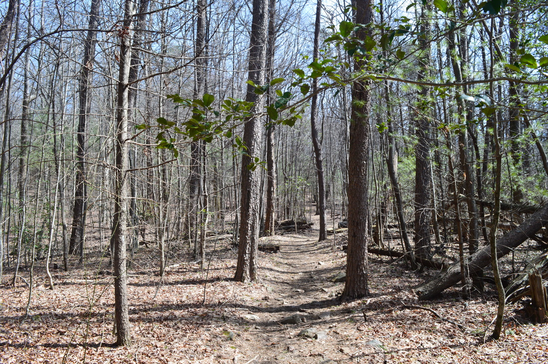
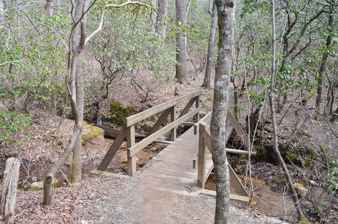
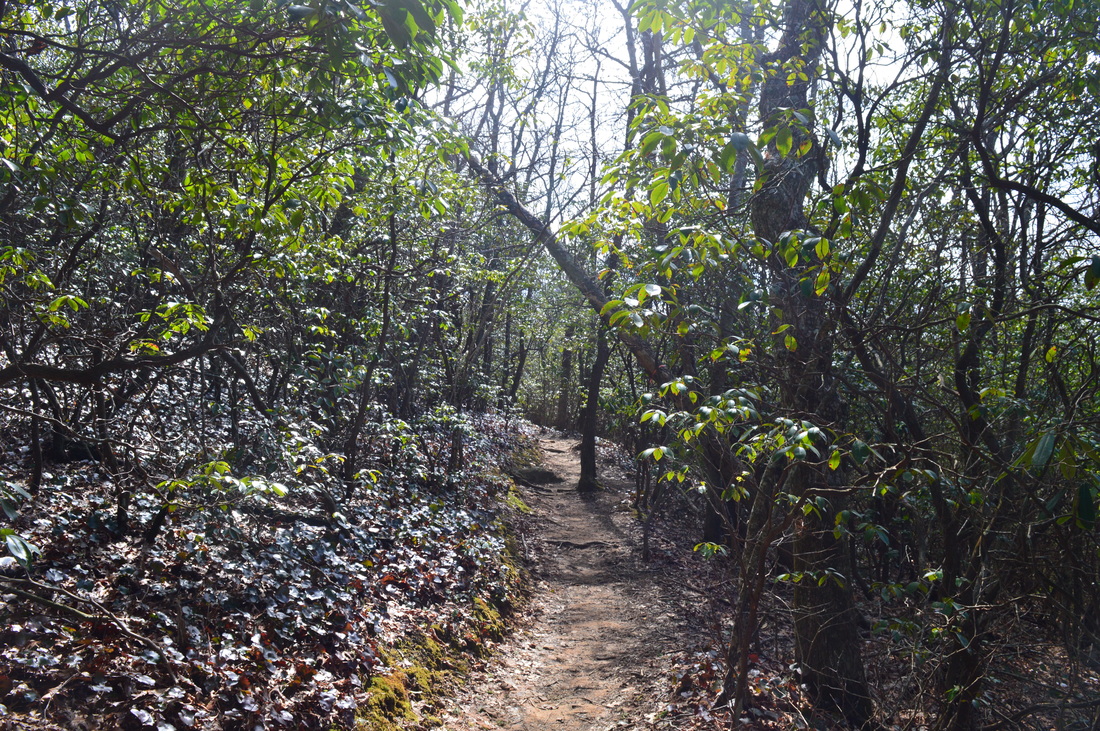
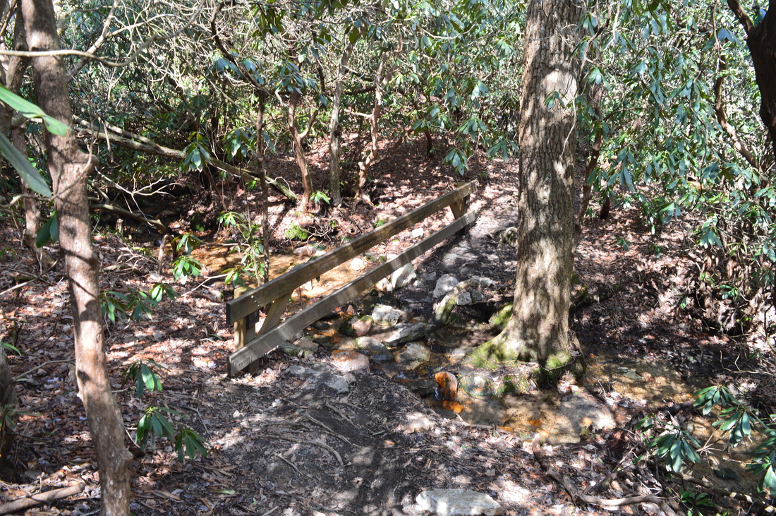
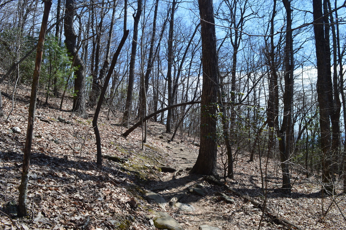
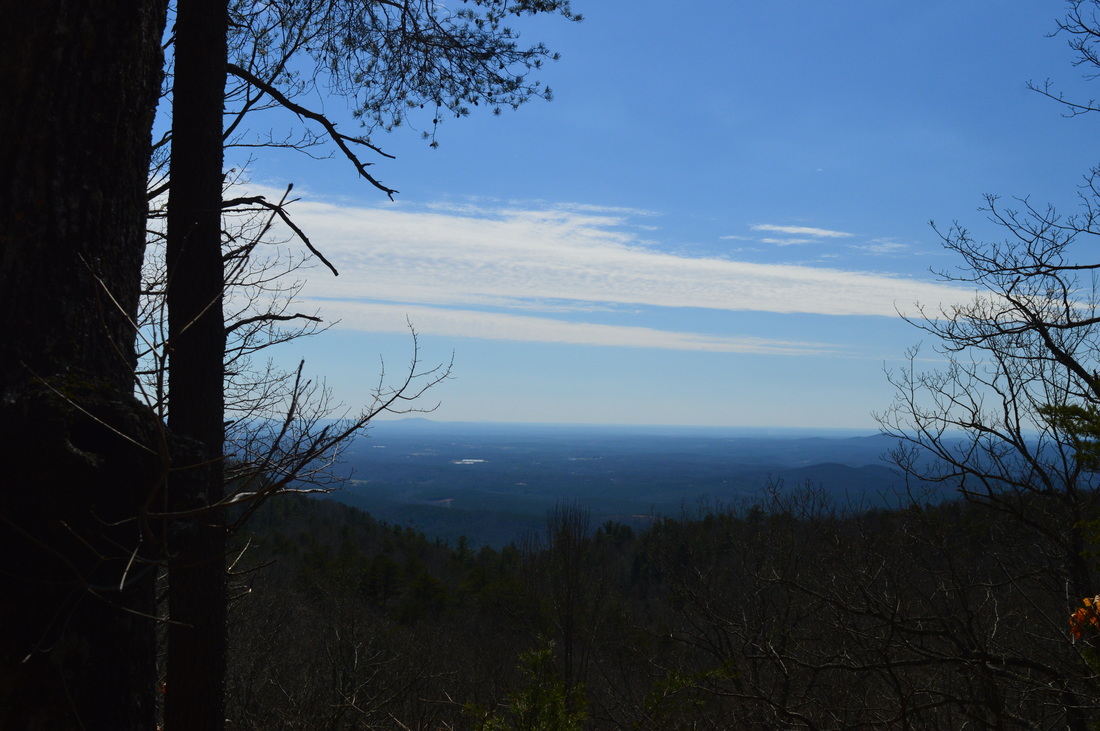
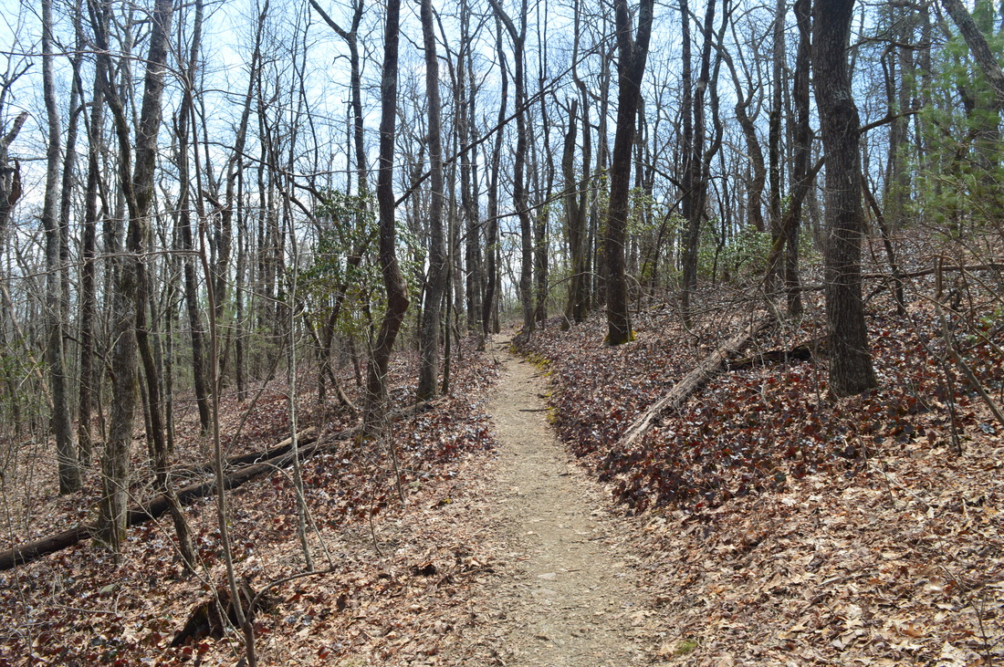
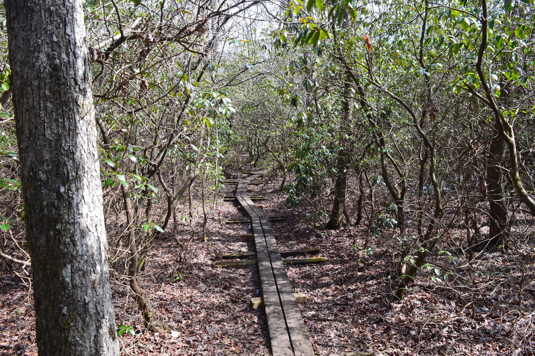
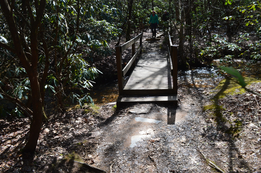
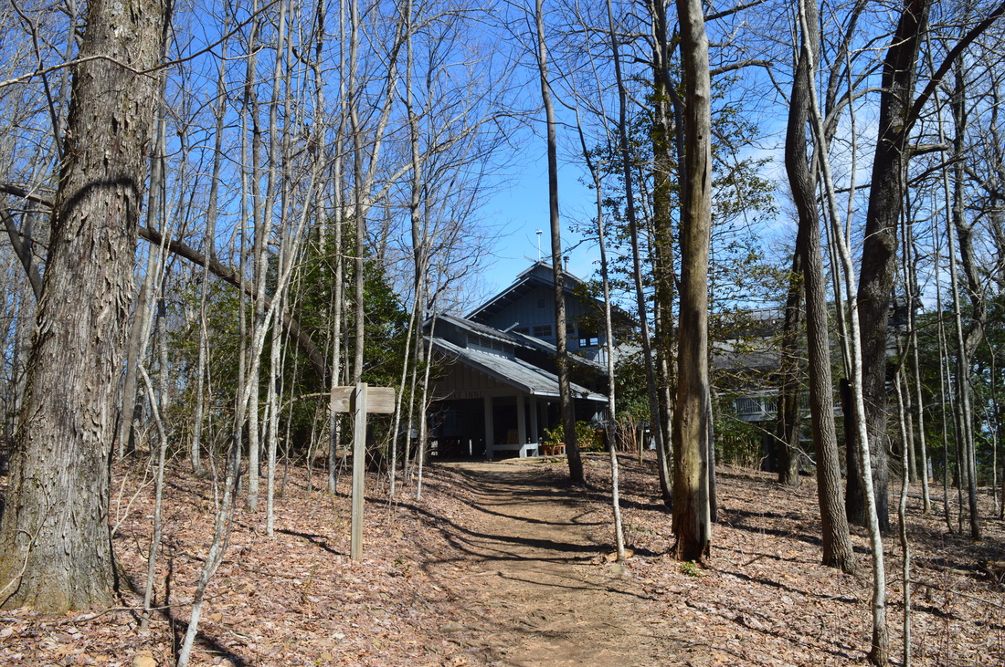
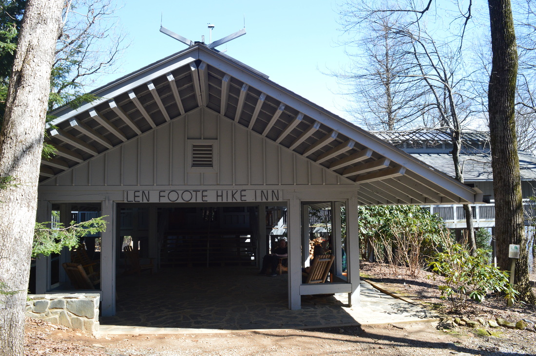
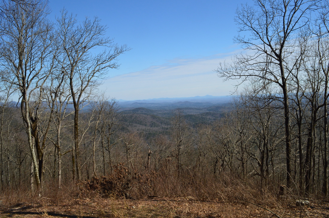
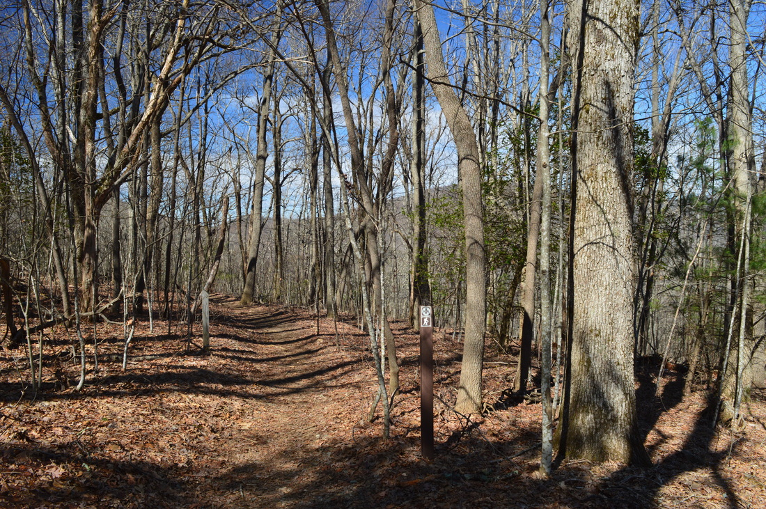
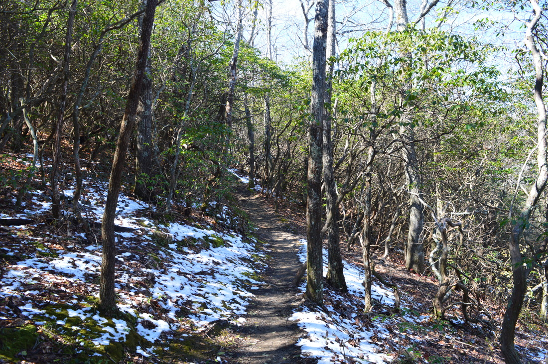
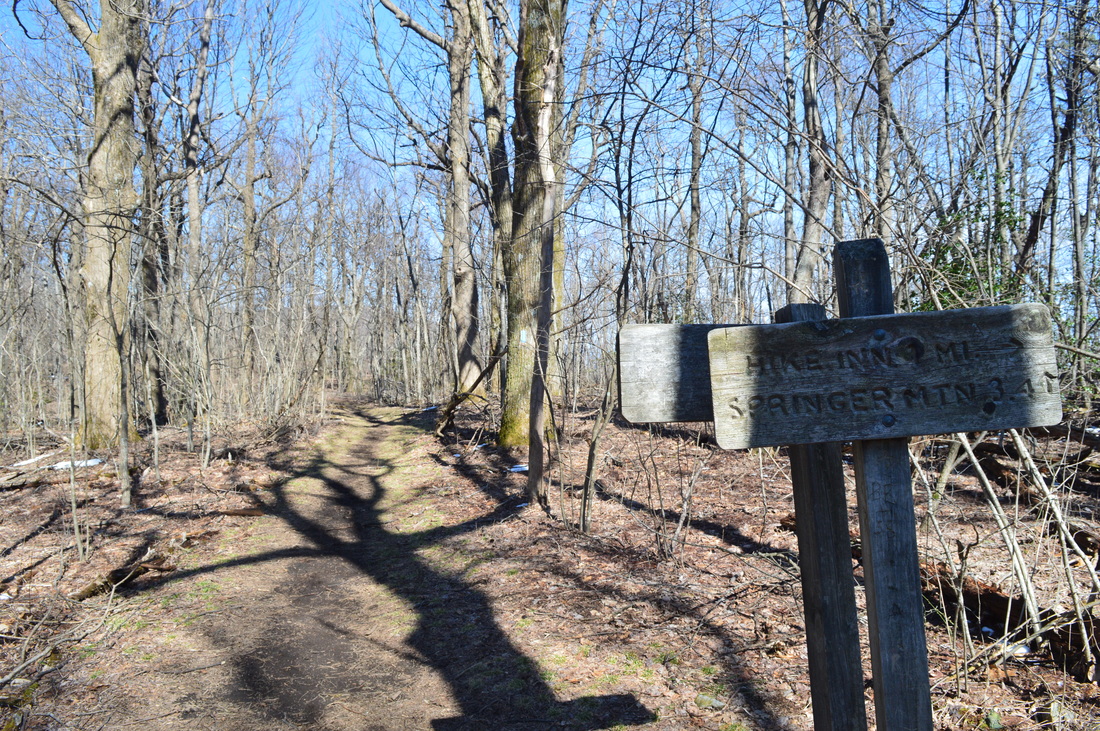
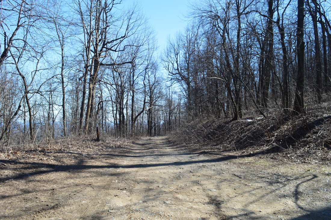
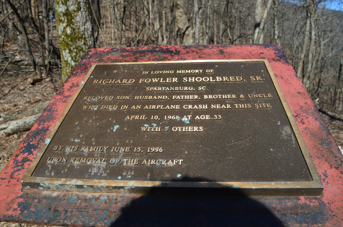
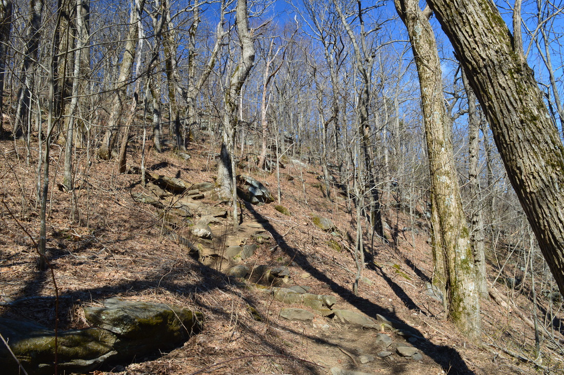
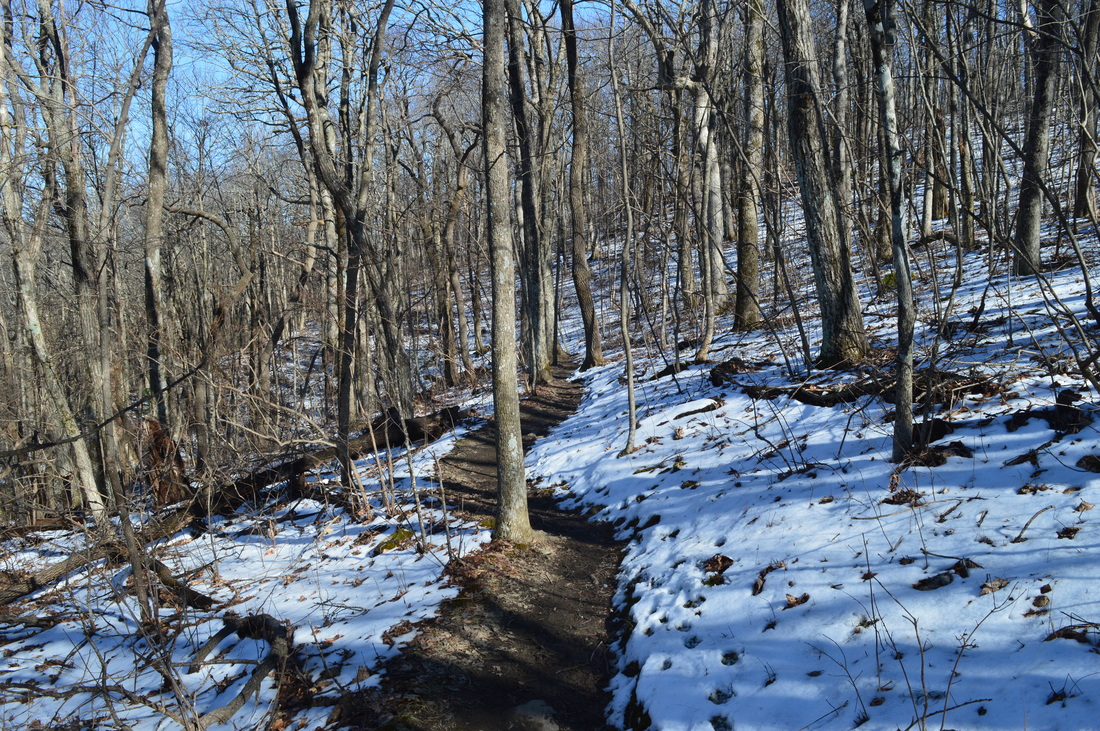
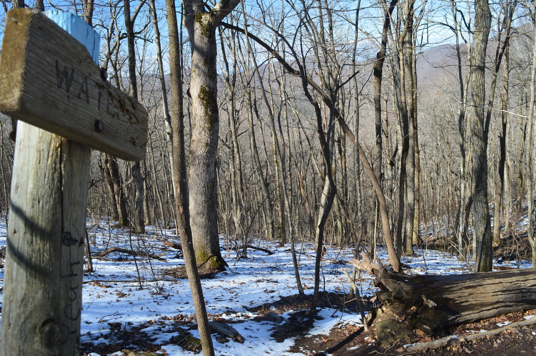
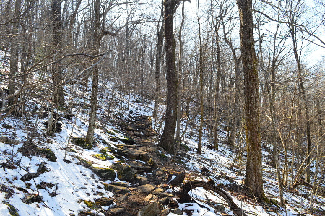
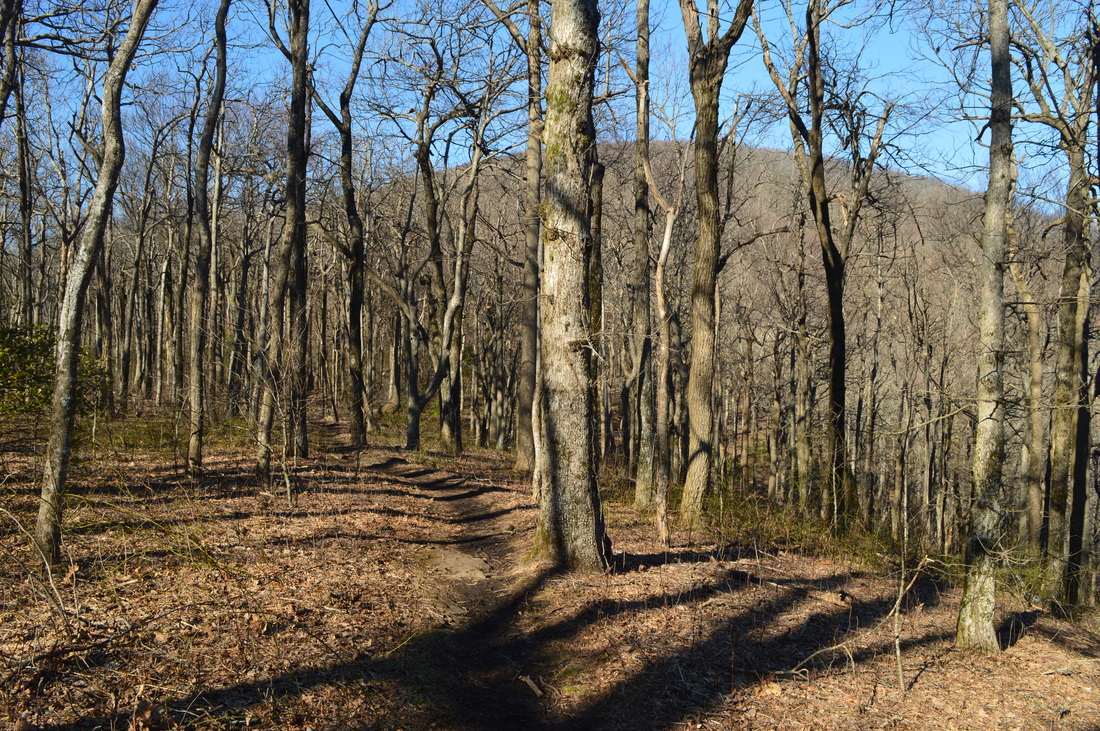
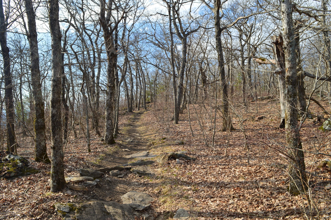
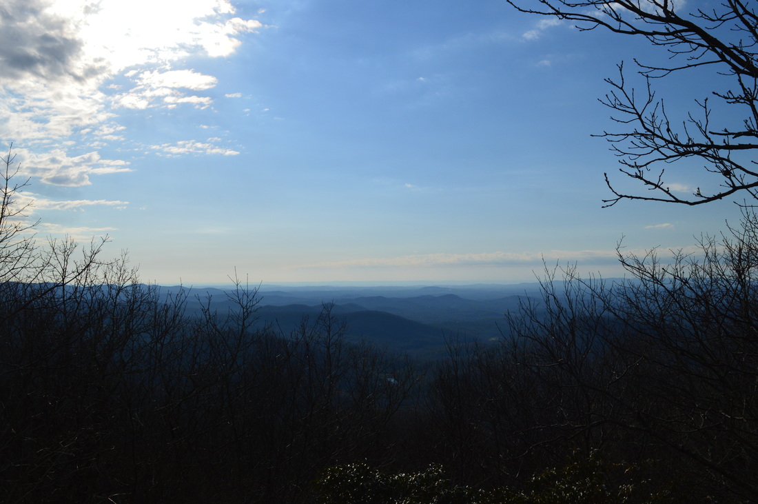
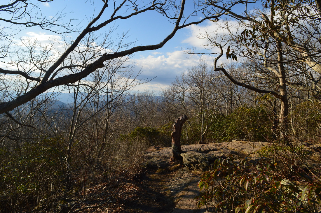
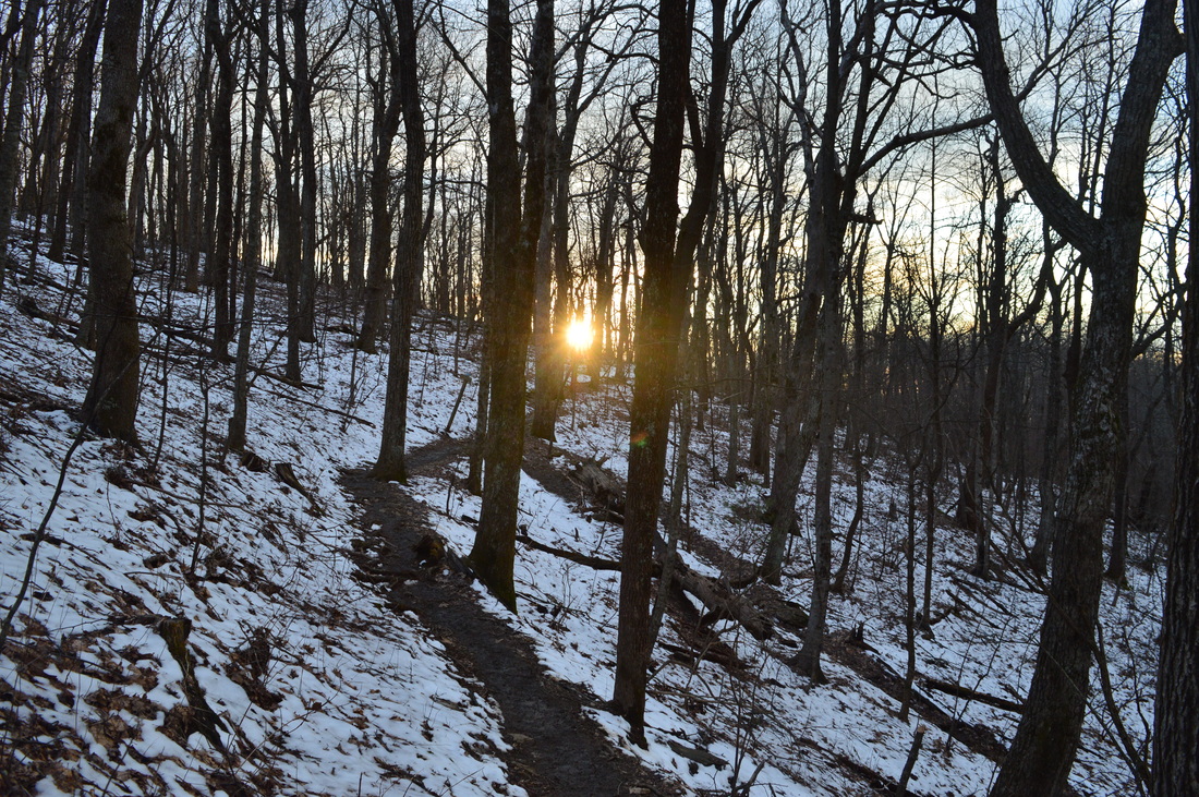
I decided to begin my hike at the Visitor Center - at the very beginning of the AT Approach Trail. Many people can "cheat" by beginning the hike at the Hike Inn Trailhead at the top of Amicalola Falls. Doing it that way makes the hike significantly easier, because it cuts out a steep ascent, complete with over five hundred steps, along Amicalola Creek. Also, another reason that some hikers skip the Amicalola Creek section is because that part of the trail is very crowded and touristy. I wanted to hike the full trail from beginning to end, so I did not skip that part. Plus, I wanted to get some pictures of Amicalola Falls. Begin by walking to the left of and behind the Visitor Center. Walk along a stone pathway under a stone arch to several signs that mark the beginning of the Appalachian Approach Trail. Beyond the stone arch, take a left to continue on the Appalachian Approach Trail - the trail that continues straight is the East Ridge Trail, your return route. Once you have turned left, shortly pass the Max Epperson Shelter to your right. Follow a wide dirt path sly approaching the park entrance road. At 0.3 miles, reach a wooden footbridge next to the entrance road. Follow the footbridge, and then cross the road. You get your first view of Amicalola Falls from here, visible on the mountain side ahead. After the road, descend to and cross Amicalola Creek on a footbridge. Even though it is full of cascades, the stream seems small. It is hard to imagine that a huge waterfall lies upstream. At 0.6 miles, reach the end of the park entrance road at a small parking area and turnaround. Here, there is a small pond on Amicalola Creek. The trail hugs the left side of the pond, which is named Reflection Pool. As the trail rounds the pond on a concrete walkway, a dirt trail leaves to the left. The trail that goes left is the Creek Trail. It leads back to the Visitor Center. Also, it connects with several other trails: Mountain Laurel Trail, Spring Trail, and West Ridge Falls Access Trail, providing an alternative route to the observation area at the base of the tallest drop of Amicalola Falls. This alternative route does not have so many steps. Also, most of it is a dirt trail, unlike the section of the AT Approach Trail from Reflection Pond to the top of Amicalola Falls, which is all paved or steps. From Reflection Pond, return to the right side of Amicalola Creek and begin ascending on a paved trail, with several flights of steps, parallel to Amicalola Creek. While technically Amicalola Falls lasts all the way to Reflection Pond, this part of the creek has a long series of cascades rather than an actual waterfall. At 0.9 miles, at a switchback in the trail, you get an excellent view of the main drop of Amicalola Falls up ahead. You can also see the impressive footbridge across Amicalola Creek at the base of the main drop. At 1 mile, reach the main drop of Amicalola Falls. Cross the creek here on a footbridge. From the footbridge, there is a fantastic view of Amicalola Falls. This has to be one of the most impressive waterfalls in Georgia, although the crowds here will detract your attention from the waterfall, unfortunately. After the footbridge, reach a junction. Here, the West Ridge Falls Access Trail continues straight to a parking area on Top of the Falls Road. That trail was designed for wheelchair use. Meanwhile, the AT Approach Trail turns right onto a long series of steps that takes the trail up the ultra-steep slope next to Amicalola Falls. There is a total of 425 steps between this point and the top of the falls. At 1.2 miles, reach the top of Amicalola Falls. From the trailhead, you have ascended around 700 feet, with 500 of those feet in a mere 0.5 miles. This shows how steep the first ascent on the hike is. From the top of the steps, turn right onto a concrete walkway that takes you across Amicalola Creek at the top of the falls. There is a great vista from here, and you can see Reflection Pool far below. From the top of the falls, ascend up a staircase to the Hike Inn Trailhead. This is the point where a lot of hikers start their trek. Most people who wish to just hike to the Hike Inn start here. The East Ridge Trail starts from the far end of the parking area - later, it will be your return route to the Visitor Center in order to avoid the steps. For now, cross the parking area and continue on the AT Approach Trail uphill. Shortly afterwards, make a left turn - the trail that goes straight leads to the lodge. At 1.4 miles, cross the road that leads to the lodge. At 1.5 miles, reach an important intersection. Here, the AT Approach Trail continues straight towards Frosty Mountain and eventually Springer Mountain, while the Hike Inn Trail veers right towards the Len Foote Hike Inn, before reconnecting with the AT Approach Trail near Nimblewill Gap. Bear right onto the Hike Inn Trail and begin a slight ascent. I noticed some traces of snow here and there, left over from snowfall two days ago. Much of the Hike Inn Trail is similar, with several descents and ascents. At 2 miles, you will follow a small ridge-like area, followed by a minor vista. Then, the trail descends before passing over a couple of hills. At 3.4 miles, pass over an unnamed summit with winter views and with an area where there are log benches. Then, descend into a valley, and cross an unnamed tributary of Cochrans Creek at 3.9 miles. After this, the pattern repeats as the trail ascends to near the summit of another unnamed knob. Cross one arm of a second tributary of Cochrans Creek at 5 miles. Pass through a rhododendron jungle along the creek and then cross the second arm of the tributary. Then, ascend again along the slopes of yet another unnamed knob. At around 5.3 miles, there is another minor vista where you can look southward. At 5.8 miles, enter a bottomland near Cochrans Creek. This area can become muddy/soggy, and for this reason, several boardwalks were placed along the trail. At 5.9 miles, cross Cochrans Creek on a footbridge. After this, begin the final ascent to the Len Foote Hike Inn. There is a network of nature trails around the Hike Inn, and I am not sue of their extent, but you will pass one such trail to your right at 6.2 miles. It is marked by a sign as "Cove Trail" and "Firebreak Trail". The Fire Break Trail later rejoins the main trail later, after the Hike Inn. It seems like the Fire Break Trail passes to the east and north of Hike Inn. At 6.3 miles, reach the Len Foote Hike Inn. This eco-lodge is home to 20 rooms. Breakfast and dinner is served at the Hike Inn, so hikers who would like to stay in the inn are not required to bring their own food. Also, the Hike Inn has a bathhouse with hot showers and composting toilets. On this day, however, I was not planning to stay at the Hike Inn - I merely made a short stop before continuing to Springer Mountain. The Hike Inn Trail continues to the left of the main entrance to the inn. However, before you continue up the trail, walk behind the Hike Inn to a small vista at the back of the building. From the vista, return to the main trail and cross a gravel road that seems to be the service road for the Hike Inn. After the service road, descend briefly to a junction with the other end of the Fire Break Trail. From here, it is mostly moderate uphill to the AT Approach Trail. There are several great winter views to the east and southeast towards Bull Mountain and Jake Mountain, and later, to the northeast towards Black Mountain. At 7.3 miles, summit the unnamed knob that you have been ascending. Then, descend gently to a junction with the AT Approach Trail at 7.4 miles and the end of the Hike Inn Trail. Here, you can turn left to return to Amicalola Falls State Park by way of Frosty Mountain, making for a shorter loop hike. However, my plan was to first hike out and back to Springer Mountain, so I turned right onto the AT Approach Trail. For a short time, follow a ridge that extends from the knob. This easy, flat trail won't last long though. At 7.7 miles, the ridge suddenly ends and the trail starts an ultra-steep descent to Nimblewill Gap, with Black Mountain looming straight ahead. In the next 0.3 miles, the trail descends 300 feet straight down without any switchbacks - just imagine the ascent that you will face on your way back. Luckily, it's not very long. At 8 miles, reach Nimblewill Gap and cross Nimblewill Gap Road. There is a commemorating plaque here regarding a plane crash that occurred nearby on April 10, 1968. As you direct your attention away from the plaque, you will notice a gated forest road that also leaves the gap to the left at an acute angle. The main road that passes through the gap, Nimblewill Gap Road (Forest Road 28-2) is known as a rough dirt road that is not suitable for regular passenger vehicles, with four wheel drive and high clearance as a must. To the right of the gap, the road seemed decent, but to the left, it seemed in bad shape. I have heard that to the right of the gap, Nimblewill Gap Road has been recently graded and improved (from Nimblewill Church Road to Nimblewill Gap). I have never driven on the road, so I cannot confirm. After Nimblewill Gap Road, the trail makes a similar steep ascent out of the gap, although it is very short (0.1 miles). Once the initial ascent is finished, level out in a gap between Black Mountain and an unnamed knob. From here, the trail crosses to the west side of Black Mountain, avoiding a potential ascent to the summit of Black Mountain. The trail ascends very gently until 8.7 miles, when you cross a lead and begin descending towards Black Gap along the north slopes of Black Mountain. On this side of Black Mountain, there was actually a mostly unbroken coating of snow that had not yet melted in most areas besides the trail. The trail itself was a muddy mess here, a result of melted snow. At 9 miles, pass a side trail on the left that leads to a water source. The water source is a tributary of Tickanetley Creek. Continue descending, and reach Black Gap at 9.4 miles. This is a popular camping area. A spur trail to the left leads to the Black Gap Shelter - a typical Appalachian Trail shelter. Following Black Gap, the trail return to sunnier and drier areas as it begins the final ascent to Springer Mountain. First, ascend to a lead that extends from Springer Mountain. Cross the lead at 9.6 miles, and then follow the north side of the lead. Springer Mountain looms ahead. At 10.1 miles, reach a gap, and then bear right to begin ascending Springer Mountain itself. The ascent is generally easy to moderate, with several switchbacks. At 10.7 miles, near the summit of Springer Mountain, there is a short section of trail that is rocky and steeper. At 10.9 miles, level out on the elongated summit of Springer Mountain, and at 10.95 miles, reach the end of the Appalachian Approach Trail at the official summit of Springer Mountain and the Springer Mountain vista. From the overlook, there is a limited view to the west. The summit of Springer Mountain, as well as this overlook, marks the southern terminus of the Appalachian Trail, a 2160-mile foot trail that begins at Springer Mountain, Georgia, and ends at Mount Katahdin, Maine. Most casual hikers will reach Springer Mountain by a much easier route, either from Forest Road 42 or from Forest Road 58 in Three Forks. In the summer of 2015, I completed a loop hike from Three Forks to Springer Mountain, utilizing both the Appalachian Trail and Benton Mackaye Trail. That route to Springer Mountain was significantly easier and shorter than this one. You can read more about my hike from Three Forks here. Springer Mountain is your turnaround point. From Springer Mountain, retrace your steps along the AT Approach Trail. At 14.5 miles, return to the junction with the Hike Inn Trail. From here, continue straight on the AT Approach Trail as you continue onto the loop section of the hike. Begin descending off the knob near the junction. At 14.7 miles, bottom out in a gap below Frosty Mountain and cross Forest Road 46. This is the same road that was gated in Nimblewill Gap. It connects Nimblewill Gap and Amicalola Falls State Park, It is unclear to me if this road is ever open for public use. It is listed on the Chattahoochee National Forest Forest Service Road Map, but there is no information about the road. The road seems to be in fairly good condition, at least in this area (it seemed worse at Nimblewill Gap), From the FS 46 crossing, begin ascending up Frosty Mountain. This is a moderate ascent, and it is not very long. At 15 miles, reach the summit of Frosty Mountain. To the right, a spur road from FS 46 reaches its end. On the summit of Frosty Mountain, bear left and then immediately right at a potentially confusing junction of forest roads. To your right, you will see the overgrown foundations of a fire tower that once stood on top of this mountain. Once you're clear of the summit, you will lose no time in beginning a rather steep descent towards High Shoals Road. At 16 miles, the descent is briefly broken as you reach a lead and briefly follow it to a knob on the lead. At 16.1 miles, cross the summit of the knob and begin descending again. The descent becomes very steep. At 16.55 miles, cross High Shoals Road (a gravel road) and continue descending steeply. At 16.7 miles, the trail suddenly bottoms out at the head of a valley. As the forest resonated from the screeching of a nearby barred owl, I realized that I suddenly was beginning yet another ascent. By now, my legs were quite jelly from the multitude of ascents on the hike, the mileage covered, and the ultra-steep descent that I had just traversed. The ascent looming ahead was a very frustrating sight. After I checked my GPS, I breathed a sigh of relief as I found out that this ascent was the last notable ascent on the hike. You will ascend moderately to an unnamed knob, reaching the summit at 17.6 miles. After this, begin another moderate to steep descent into the Amicalola Creek valley. At 18.1 miles, cross High Shoals Road again (paved this time). Bear left as you cross the road and bottom at out at Amicalola Creek, before crossing a footbridge across the creek. After this, make a brief ascent out of the creek's valley. At 18.3 miles, close the loop as you reach a junction with the Hike Inn Trail. From this junction, continue straight on the Appalachian Approach Trail. Cross the lodge road, make the right turn, and reach the Hike Inn Trailhead at 18.6 miles. This is where I started the second, smaller loop (although I recommend using the Appalachian Approach Trail with its steps rather than the rugged East Ridge Trail after such a long and difficult hike!). To continue onto the East Ridge Trail, walk down the large parking area at the Hike Inn Trailhead. Walk past the restrooms and reach a gated service road at the end of the parking area. This is where the "fun" begins. Begin walking down a steep, rocky, rough, and very eroded service road. It is hard to hike at a fast pace here due to the large amounts of rocks everywhere on the road. Shortly after the beginning of the East Ridge Trail, you will pass a small opening to the right with a view. After a while, the road becomes less eroded and this is where you can increase your pace. At 19 miles, the East Ridge Trail leaves the road and bears right onto a single track trail, while the service road continues straight to its terminus near the park entrance. The single track trail is still somewhat rugged as it descends, but there are some helpful switchbacks. At 19.6 miles, reach the end of the East Ridge Trail at the stone arch and AT Approach Trail beginning behind the Visitor Center. From here, walk past the Visitor Center and to the parking area, concluding this strenuous hike at 19.7 miles. Mileage
0.0 - Amicalola Falls State Park Visitor Center
0.1 - Turn left onto AT Approach Trail 0.3 - Cross entrance road 0.6 - Reflection Pool 1.0 - Amicalola Falls 1.2 - Top of Amicalola Falls and Hike Inn Trailhead 1.4 - Cross lodge road 1.5 - Keep right onto Hike Inn Trail 2.0 - Vista 5.3 - Another vista 5.9 - Cochrans Creek 6.3 - Len Foote Hike Inn 7.4 - Turn right onto AT Approach Trail 8.0 - Nimblewill Gap 9.4 - Black Gap 10.95 - Summit of Springer Mountain; turnaround point; southern terminus of the AT 14.5 - Return to Hike Inn junction, continue on AT Approach Trail 14.7 - Cross FS 46 15.0 - Frosty Mountain 16.55 - Cross High Shoals Road 18.1 - Cross High Shoals Road again; Amicalola Creek 18.6 - Hike Inn Trailhead; continue onto East Ridge Trail 19.6 - End of the East Ridge Trail near visitor center 19.7 - Amicalola Falls State Park Visitor Center Variations
Make a short loop around Amicalola Falls using AT Approach Trail and East Ridge Trail - 2.3 Miles
Make a double loop using AT Approach Trail, Hike Inn Trail, and East Ridge Trail without the Springer Mountain extension - 12.6 Miles Bonus Stops
If you're feeling up to it, there's several additional trails in Amicalola Falls State Park.
PicturesVideos
2 Comments
Linda Cantrell
5/20/2016 02:58:51 pm
Great reporting. You sure you are only fifteen? No just kidding. Waiting to hear from you soon.
Mark Oleg
5/20/2016 09:29:52 pm
Thanks! I am glad that you liked the trail reports on this website! Leave a Reply. |
About MeMark Oleg Ozboyd Dear readers: I have invested a tremendous amount of time and effort in this website and the Georgia Waterfalls Database the past five years. All of the work that has gone in keeping these websites updated with my latest trip reports has almost been like a full-time job. This has not allowed me to pick up a paid job to save up money for college, and therefore, I I've had to take out loans. If you find the information on this website interesting, helpful, or time-saving, you can say "thanks" and help me out by clicking the button above and making a contribution. I will be very grateful for any amount of support you give, as all of it will apply toward my college tuition. Thank you!

Coming in 2022-2023?
Other Hiking WebsitesMiles HikedYear 1: 540.0 Miles
Year 2: 552.3 Miles Year 3: 518.4 Miles Year 4: 482.4 Miles Year 5: 259.9 Miles Archives
March 2021
Categories
All
|


 RSS Feed