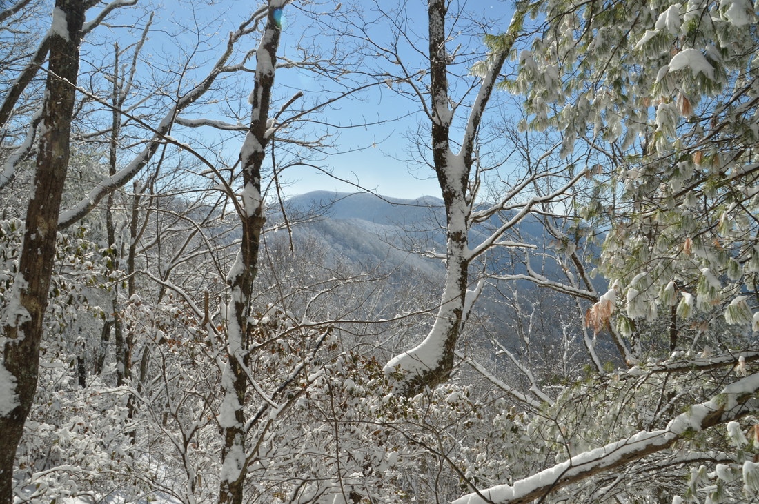
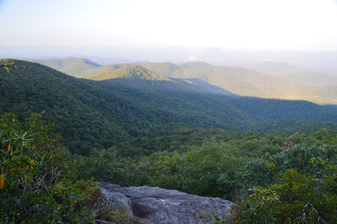
Folks who live in the Atlanta metro area are very familiar with the Chattahoochee River: one of Georgia's largest rivers and a source of drinking water for many. But where does the river begin? In the North Georgia Mountains near Helen and Hiawassee, where a tiny spring gives birth to a rivulet that is the same Chattahoochee River as the one that feeds Lake Lanier and Walter F. George Lake. The Jacks Knob Trail in Chattahoochee National Forest's Mark Trail Wilderness is the shortest route to the source of the Chattahoochee River. The Chattahoochee Spring isn't the only point of interest in the area, however; two nearby creeks drop off the north side of the Tennessee Valley Divide and form large waterfalls on their way into the Hiwassee River valley. This hike occurred on Saturday, January 7th, 2017. My plan was to hike the Jacks Knob Trail from Jacks Gap to Chattahoochee Gap. After seeing the Chattahoochee Spring, I would hike the Appalachian Trail from Chattahoochee Gap to Red Clay Gap. This is where I would pick up an unofficial side trail north into the Joel Creek valley, visiting Joel Creek Falls and Gurley Creek Falls. I would return to Jacks Gap by walking along Route 180.
4 Comments
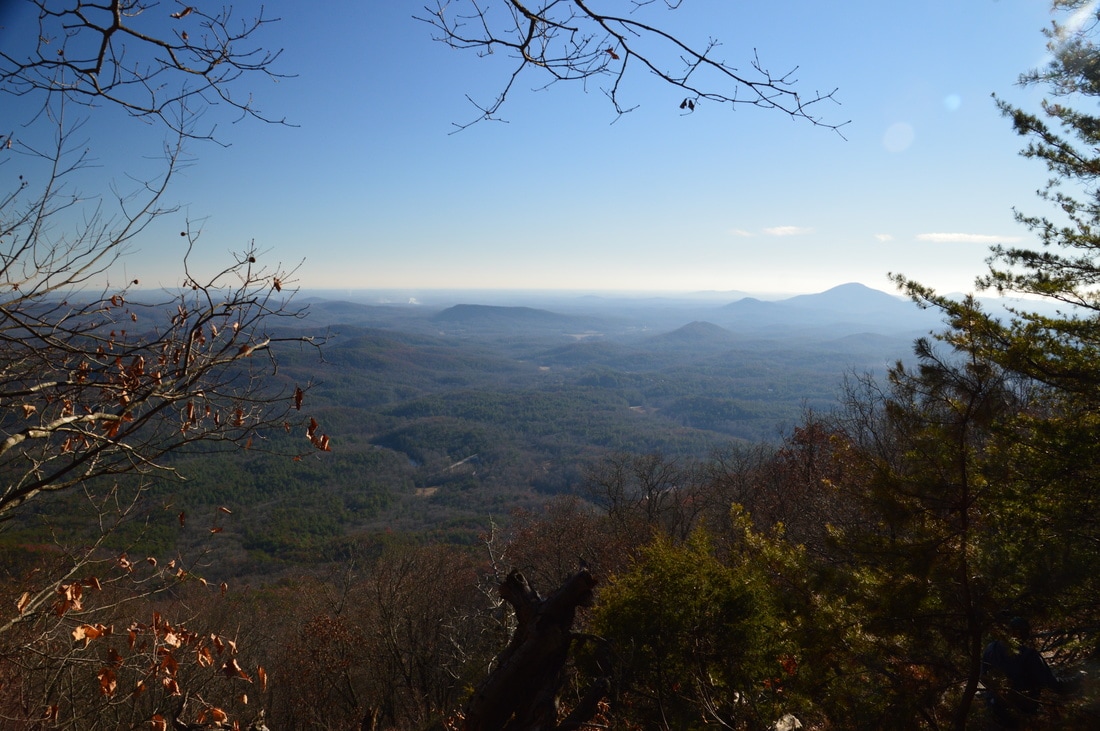
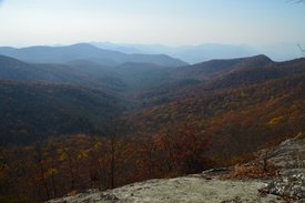
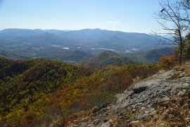
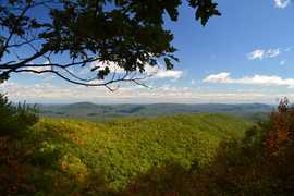
The Tray Mountain Wilderness is perhaps the least-explored wilderness area in Georgia. The focal point of the wilderness is Tray Mountain, which is one of the highest mountains in Georgia, and the section of the Appalachian Trail that passes over Tray Mountain. South and east of Tray Mountain, however, lies a remote area that has largely been unexplored: the Left Fork Soquee River watershed, which is home to numerous waterfalls. On the south side of the watershed stands Chimney Mountain, a lower peak that has several cliffs with great views but is overshadowed by the taller Tray Mountain only a few miles away. The hike to Chimney Mountain follows an unofficial trail that leads to a panoramic vista that faces Mount Yonah and the Georgia Piedmont. This hike occurred on Saturday, December 10th, 2016. My plan was to hike the unofficial path to Chimney Mountain out and back.
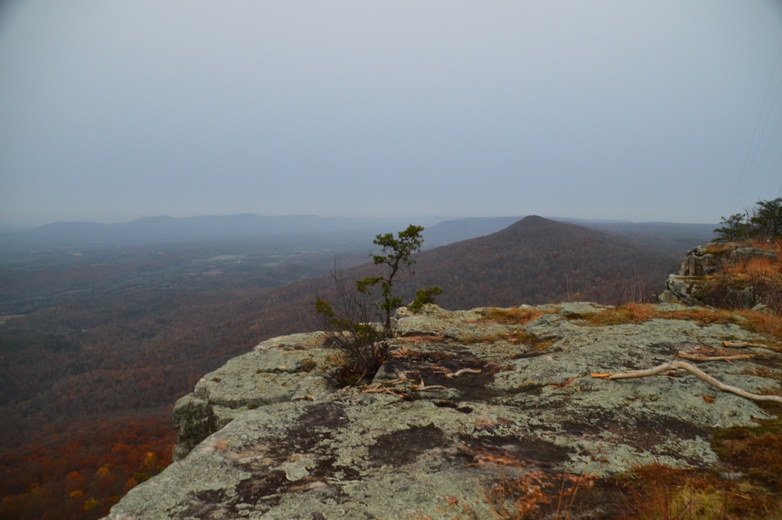
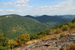
Lookout Mountain is a long linear mountain ridge that stretches roughly from Chattanooga, Tennessee, to Gadsden, Alabama. Much of the ridge has a relatively constant elevation, and the highest point on Lookout Mountain is in Walker County, Georgia. Simply and appropriately named "High Point", this rise on Lookout Mountain is home to a row of sheer cliffs that provide breathtaking views east and south into Chattanooga Valley and towards Pigeon Mountain and Taylors Ridge. Thanks to the recent acquisition of various tracts of land atop Lookout Mountain by the Lula Lake Land Trust, access to High Point has now been secured, and the 14-mile Cloudland Connector Trail provides the perfect approach into the area. This hike occurred on Saturday, December 3rd, 2016. My plan was to hike the Cloudland Connector Trail from Nick-a-Jack Road to the High Point gated service road. From there, I would follow the closed road and then a short path to the summit of High Point and an excellent vista. I would return the same way.
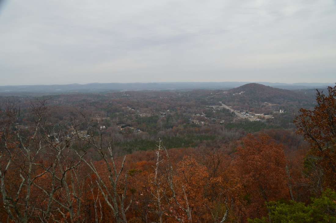
In the Valley and Ridge Province of northwest Georgia, Rocky Face Mountain is the home of a battle from the Civil War: the Battle of Dalton in 1864. Near the north end of Rocky Face Mountain is the grave of George W. Disney, a Confederate soldier who was killed during the battle, and whose grave was discovered by a group of boy scouts in 1912. Today, the George W. Disney Trail, in memory of the fallen soldier, is a short but steep trail (that is actually referred to as the steepest short trail in the state) that leads past the grave and to a pair of rock outcrops with beautiful views into the heart of the "Valley and Ridge". This hike occurred on Saturday, December 3rd, 2016. My plan was to hike the George W. Disney Trail out and back to the vistas at the north end of Rocky Face Mountain. I would also explore the Rocky Face Mountain Ridge southward for any continuations of the trail.
The Bartram Trail, which is a lesser-used footpath that stretches across portions of Georgia and North Carolina, stays close to the Tennessee Valley Divide for a number of miles in Georgia's Rabun County, passing over Rabun Bald, which is the second highest mountain in Georgia. In the vicinity, several other mountains provide noteworthy views, such as Double Knob, Flat Top Mountain, and Flint Knob. While the views from Rabun Bald are arguably better than some of these views, the other overlooks in the area are certainly worth visit as well. On this hike, you'll follow the Bartram Trail and then a side trail to three or four mountains with views in different directions. If you're feeling up to it, you will have the opportunity to tackle Rabun Bald and experience the 360-degree view from the top as well. This hike occurred on Saturday, November 12th, 2016. My plan was to hike the Bartram Trail out and back from Wilson Gap Road to Rabun Bald. Along the way, I would make the side trip to Flint Knob and possibly Alex Mountain, and I would also bushwhack up to Double Knob, in addition to seeing the view from Flat Top Mountain. Unfortunately, due to the length of the side trips, I was not able to hike the Bartram Trail from Flint Gap to Rabun Bald.
Chattooga River Trail: Sandy Ford Road to Dicks Creek Falls to Russell Bridge, Clayton, Georgia1/12/2017 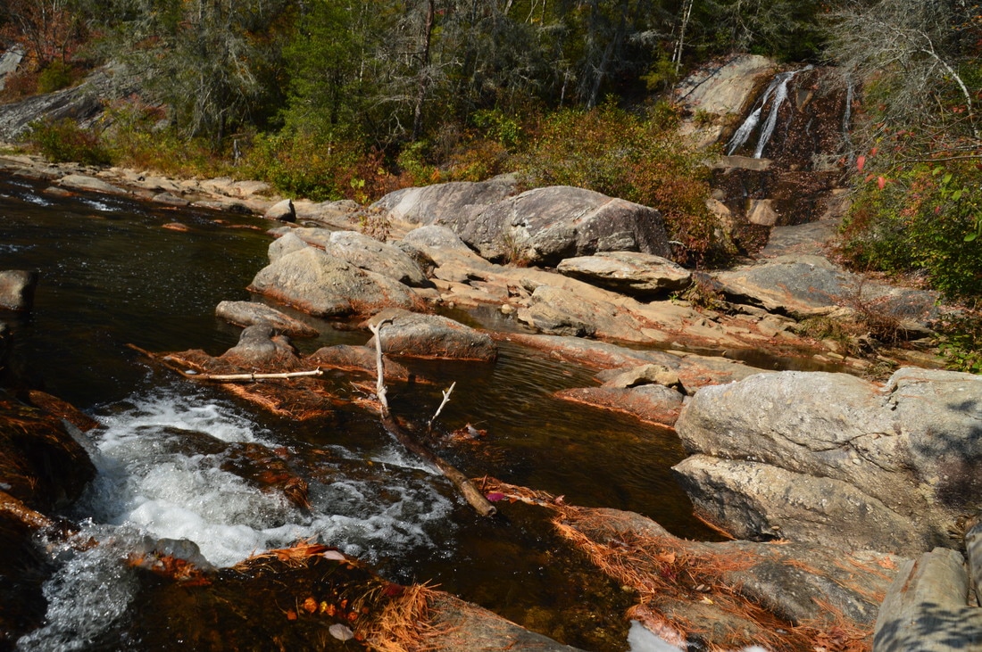
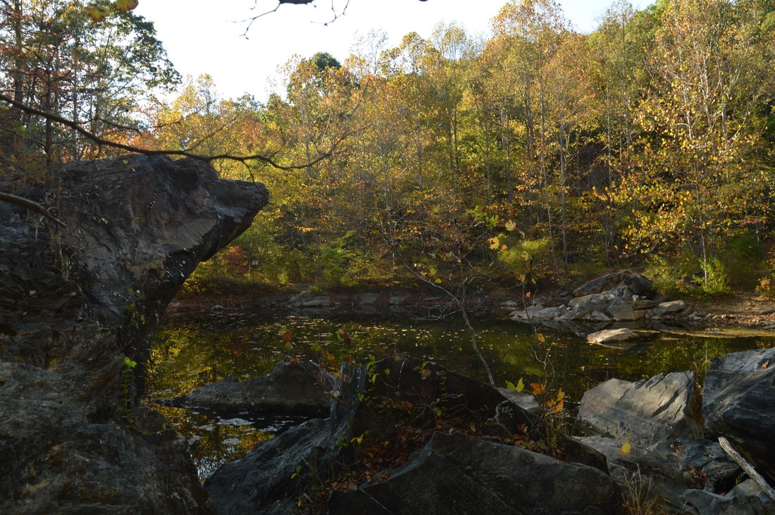
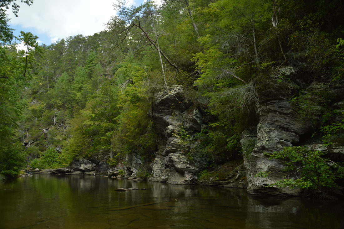
The Chattooga Wild and Scenic River is one of the longest and largest remaining wild waterways in the southeastern US, with no dams and very little human development for all of its length down to Lake Tugaloo. In fact, it is the only wild and scenic river east of the Mississippi River that is actually commercially rafted. For nearly twenty miles, the Chattooga River Trail stays near the river or even follows it along its Georgia side. Unfortunately, the Georgia Chattooga River Trail leaves something to be desired, as there are surprisingly few views of the river throughout the length of the trail. Still, the Chattooga River Trail passes by several points of interest, including Dicks Creek Falls on Section Two. This hike occurred on Saturday, November 5th, 2016. My plan was to hike the Chattooga River Trail from the Sandy Ford Road/Dicks Creek Falls trailhead to the Russell Bridge Trailhead. This is also known as Section Two of the Chattooga River Trail. Along the way, I would take side trips to Dicks Creek Falls and Adline Ford. I arranged to have two cars for this point-to-point hike: one car was placed at the Sandy Ford Road trailhead, and another car was placed at Russell Bridge on Highway 28.
One of the newest additions to Bartow County's trails, the Pine Log Creek Trail is a short hike that passes over and around several hills in the vicinity of Pine Log Creek, before visiting an old water-filled CCC quarry. The Pine Log Creek Trail is also located conveniently close to metro Atlanta, and even though the trail does not have the outstanding features of many mountain trails, it could still serve as a great after-work outing for people from the northwest metro. This hike occurred on Saturday, October 29th, 2016. My plan was to hike the West Loop of the Pine Log Creek Trail clockwise and the East Loop of the Pine Log Creek Trail counter-clockwise. Along the way, I would take the side trail to the old CCC Quarry.
The Southern Nantahala Wilderness is a large wilderness area that stretches across portions of far northeast Georgia and southwest North Carolina. The Georgia side of the wilderness has a distinct lack of trails (other than a short section of the Appalachian Trail), which is unusual for Georgia wilderness areas. However, the lack of official trails does not mean that there are less points of interest. The Georgia side of the Southern Nantahala Wilderness is home to a number of tall peaks, including Hightower Bald and Eagle Mountain. On this hike, you will follow various old logging roads to the summit of Eagle Mountain, a 4000-foot mountain where a fantastic vista awaits. In my opinion, the view from the top of Eagle Mountain is one of the best - if not the best - vista in Georgia. This hike occurred on Saturday, October 22nd, 2016. My plan was to use several old logging roads, which appear to receive horse use and ATV use, to hike out and back to the summit of Eagle Mountain from the gate at the end of the drivable portion of Bell Gap Road.
Blood Mountain Wilderness: Slaughter Creek Loop and Blood Mountain via Freeman Loop, Suches, Georgia12/20/2016 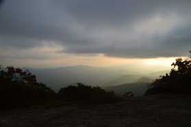
Blood Mountain is one of the best-known mountains in Georgia for a variety of reasons, including the ease of access to the great views from the several rock slabs near the summit of the peak. The easiest approach to the top is from Highway 129, but several other trails, in addition to the Appalachian Trail itself, are found in the vicinity of Blood Mountain. Two such trails - the Jarrard Gap Trail and Slaughter Creek Trail - leave the Lake Winfield Scott Recreation Area and access the AT west of Blood Mountain. Another trail, the Freeman Trail, winds around hollows on the south side of Blood Mountain, providing a tricky passage through numerous boulder fields. You'll walk all of these trails as you hike to Blood Mountain using the "back way". This hike occurred on Saturday, October 15th, 2016. My plan was to hike the Jarrard Gap Trail from Lake Winfield Scott to the Appalachian Trail, from where I would follow the AT to the Freeman Trail, taking the spur trail to Woods Hole Shelter. Then, I would take the Freeman Trail around the south side of Blood Mountain, before meeting the Appalachian Trail again and following it to the top of Blood Mountain. I would finish the hike by descending on the Appalachian Trail to the Slaughter Creek Trail and taking the Slaughter Creek Trail back to Lake Winfield Scott.
The Appalachian Trail has both grand vistas as well as much smaller ones that are equally breathtaking. The view from Wolfstake Knob falls into the latter category. Located on the Tennessee Valley Divide, Wolfstake Knob provides a memorable view to the east with Lake Burton and the mountains of Rabun County in the picture. On this hike, you will follow the Appalachian Trail to the great view from Wolfstake Knob, and then, you will continue following the footpath which becomes much less used and provides plenty of solitude around Kelly Knob and Addis Gap. This hike occurred on Saturday, October 8th, 2016. My plan was to hike the Appalachian Trail out and back from Dicks Creek Gap to Addis Gap. I would take the spur trail to Wolfstake Knob and its views, as well as the spur trail to Deep Gap Shelter, along the way.
The Appalachian Trail in Georgia passes through some of the state's highest terrain, passing many different views. Some are very popular, such as Springer Mountain, Blood Mountain, and Tray Mountain. But the best and perhaps underrated view lies on Cowrock Mountain: a 3800-foot peak that lies in the Raven Cliffs Wilderness on the Blue Ridge Valley Divide. The Appalachian Trail passes right over the summit of the mountain, and just to the south of the AT, a pair of magnificent vistas await. To the east of Cowrock Mountain, the Appalachian Trail passes over a second mountain - Wildcat Mountain - where another rock slab gives additional views. Furthermore, a lesser-used access trail, known as the Logan Turnpike Trail, joins the AT between the two mountains via the picturesque Town Creek valley along the route of an old toll road. On this hike, you will use the Logan Turnpike Trail to reach the Appalachian Trail and visit both Cowrock Mountain and Wildcat Mountain. This hike occurred on Saturday, September 17th, 2016. My plan was to hike the Logan Turnpike Trail up to Tesnatee Gap, where it joins the Appalachian Trail. From there, I would first hike the AT northbound over Wildcat Mountain and to Hogpen Gap. Then, I would return to Tesnatee Gap, and I would hike the AT southbound to Cowrock Mountain. I would finish the hike by retracing my steps to Tesnatee Gap and down the Logan Turnpike Trail.
Rocky Mountain and Tray Mountain are two rocky peaks with impessive views on the Appalachian Trail in north Georgia near Helen. Tray Mountain is also the seventh-highest mountain in Georgia. Other than the Appalachian Trail, a couple of additional trails are used to access the area. The Rocky Mountain Trail bends around the northern side of Rocky Mountain, which serves as a bypass for the rocky summit area of Rocky Mountain as well creates a popular loop hike. The Andrews Cove Trail begins nearly two thousand feet below the summit of Rocky Mountain and ascends through a lush mountain cove past several small tumbling streams before joining the Appalachian Trail. On this hike, you will first ascend along the Andrews Cove Trail to the Appalachian Trail, before hiking the Rocky Mountain Loop past the great views from the namesake peak, and finishing with an outing along the AT to the summit of Tray Mountain, where more views await. This hike occurred on Saturday, September 10th, 2016. My plan was to hike the Andrews Cove Trail to the Appalachian Trail at Indian Grave Gap. From there, I would hike the Rocky Mountain Loop clockwise, and then, I would hike the Appalachian Trail out and back to the summit of Tray Mountain as well as locate a little-known vista on the mountain's east side. I would finish by retracing my steps along the Andrews Cove Trail.
Looking at a topographic map of the Jacks River area, one can easily make out the iconic Horseshoe Bend in the river, where the land sticks out in the form of a horseshoe. The Jacks River Trail is a trail that is over a dozen miles long and has over forty river fords, as it follows the Jacks River for much of its length and crisscrosses it numerous times. This trail provides the easiest access into the beautiful stretch of the Jacks River at Horseshoe Bend. A lesser-used trail known as the Horseshoe Bend Trail can be used to accessed the area as well, and there's also a catch: it passes mere feet away from one of the most beautiful vistas in the Cohutta Mountains. On this hike, you'll first hike through upland areas south of the Jacks River, passing the spectacular Horseshoe Bend vista, before hiking through the scenic Jacks River Gorge to Jacks River Falls. This hike occurred on Saturday, September 3rd, 2016. My plan was to follow the Horseshoe Bend Trail from FS Road 51 to the Jacks River Trail. From there, I would hike out and back along the Jacks River Trail upstream to Jacks River Falls, and then, I would follow the Jacks River Trail downstream to the Alaculsy Trailhead. I arranged to have two cars for this point-to-point hike: one car was placed at the Horseshoe Bend Trailhead and another car was placed at the Alaculsy Jacks River Trailhead.
While this hike is actually in Georgia, the parking for it is in South Carolina, and you'll walk across the state line as you cross the Highway 76 bridge across the Chattooga River. In fact, the entire hike stays close to the state line. This is because the Chattooga River straddles the Georgia/South Carolina border for much of its length. The Chattooga River is a federally designated Wild and Scenic River. It is a whitewater kayaker's paradise, as there are many Class IV and Class V rapids throughout the river's course. In fact, you will get up close to Bull Sluice - a Class V rapid - on this hike, and you may even see some kayakers make their way down it. Leaving Bull Sluice, this hike will follow the Chattooga River Trail across a number of ridges near the river. Along the way, you'll be treated to several good views of this mountain river. This hike occurred on Saturday, June 11th, 2016. My plan was to hike the Chattooga River Trail from the Highway 76 bridge to Sandy Ford Road, making the short side trip to Bull Sluice along the way. I arranged to have two cars for this point-to-point hike: one car was placed at the Highway 76 trailhead and another car was placed at the Sandy Ford trailhead.
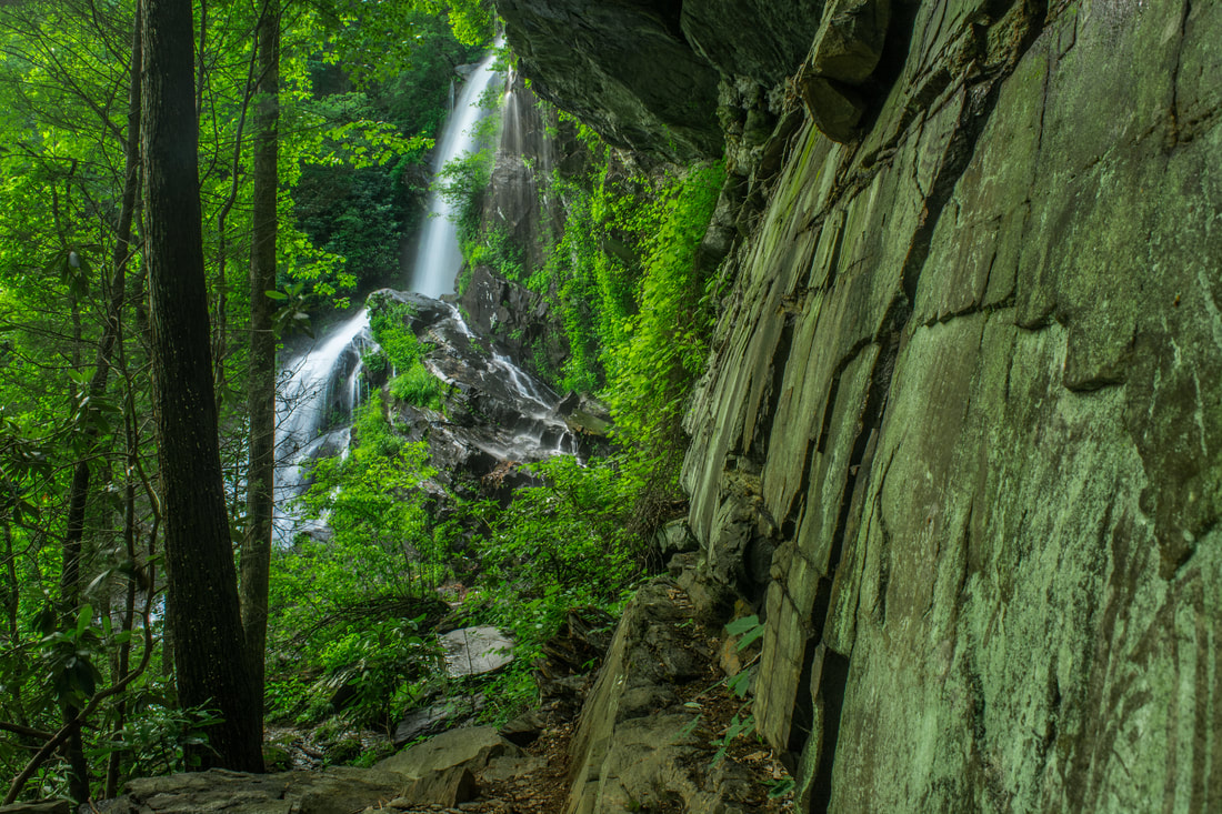
What are some of the tallest waterfalls in north Georgia? You probably have the names "Amicalola Falls" and "Anna Ruby Falls" somewhere in your head. But what about Cochrans Falls? There is a possibility that you haven't heard that name before, and for good reason. This 600-foot waterfall is only around 130 feet lower than Amicalola Falls, but it is one of the most secluded waterfalls in the entire state and has nowhere near the fame of its taller neighbor to the west. On this hike, you'll follow a jeep road into the depth of the Cochrans Creek valley, before taking a rugged and steep goat path to Cochrans Falls and the head of this remote and very scenic area. This hike occurred on Saturday, May 21st, 2016. My plan was to follow a jeep road from Blackhawk Road along Cochrans Creek. At the terminus of the road, I would take an unofficial trail that would scramble along the creek and past the numerous lower cascades and drops of Cochrans Falls all the way to the uppermost and highest drop. I returned to Cochrans Falls on Saturday, June 2nd, 2018, for better photos. This trail report has been updated with new access information, and a new photo gallery can be found below.
|
About MeMark Oleg Ozboyd Dear readers: I have invested a tremendous amount of time and effort in this website and the Georgia Waterfalls Database the past five years. All of the work that has gone in keeping these websites updated with my latest trip reports has almost been like a full-time job. This has not allowed me to pick up a paid job to save up money for college, and therefore, I I've had to take out loans. If you find the information on this website interesting, helpful, or time-saving, you can say "thanks" and help me out by clicking the button above and making a contribution. I will be very grateful for any amount of support you give, as all of it will apply toward my college tuition. Thank you!

Coming in 2022-2023?
Other Hiking WebsitesMiles HikedYear 1: 540.0 Miles
Year 2: 552.3 Miles Year 3: 518.4 Miles Year 4: 482.4 Miles Year 5: 259.9 Miles Archives
March 2021
Categories
All
|
 RSS Feed