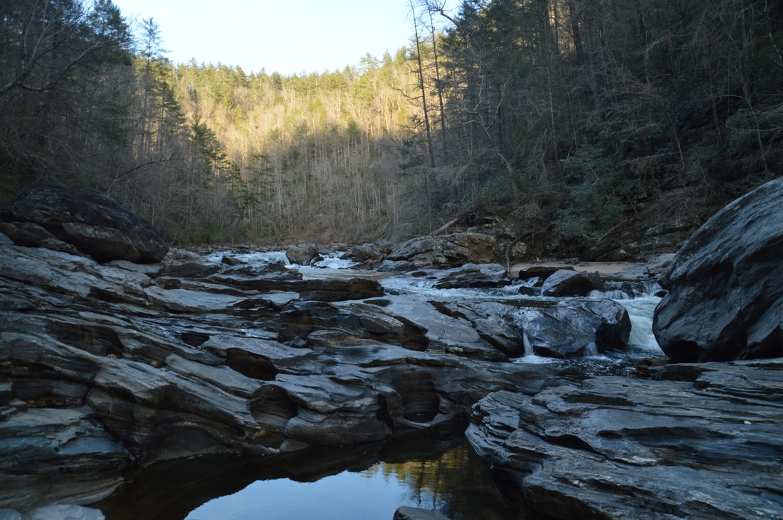
The Chattooga Wild & Scenic River is known for its lengthy and very beautiful gorge, full of rapids and waterfalls. The Canyon of Five Falls is the cream of the crop, the king of them all, perhaps one of the Chattooga River's most beautiful sections. In this 0.1-mile stretch, the river rushes over five significant Class IV or Class V rapids through a gorge full of house-sized boulders. Perhaps the most notable rapid of all is the Crack-in-the-Rock Rapid, where the mighty Chattooga River roars through three tiny slots in a line of huge boulders. In the hot weather and lower water levels of summer, this short but time-consuming hike is perfect. This hike occurred on Saturday, March 18th, 2017. My plan was to hike the Watergauge Trail, also known as the Camp Creek Trail, from the end of Watergauge Road to the trail terminus at the confluence of Camp Creek with the Chattooga River. From there, I would rock hop and wade along the Chattooga River to the Canyon of Five Falls. I would return the same way.
4 Comments
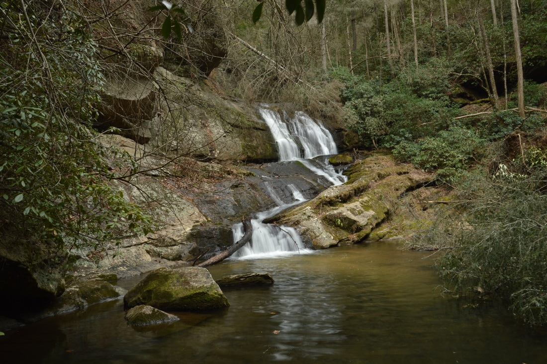
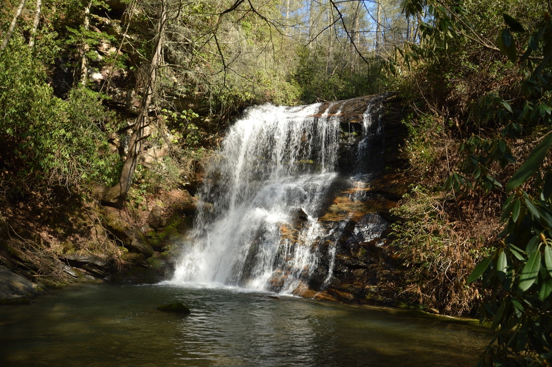
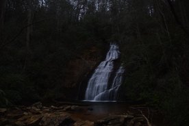
The southeast corner of Rabun County, Georgia, is not known for hiking and pristine nature as much as other parts of Rabun County, especially north of Clayton. Of course, Tallulah Gorge - which occupies the southeastern end of the county - is one of Georgia's best-known and most amazing natural sights. However, there is a lot more to this largely little-visited end of the county. At least some of the creeks in this area have photogenic waterfalls that are not documented well, both small and large, and the area is home to a section of the Wild and Scenic Chattooga River with many rapids. One of the area's more interesting remote waterfalls is a 40-footer located on Cliff Creek, nestled in a beautiful gorge among tall cliffs. This hike occurred on Saturday, March 18th, 2017. My plan was to make an exploratory bushwhack from Watergauge Road into the Cliff Creek gorge in search of a potential undocumented waterfall on Cliff Creek at a very promising location. The bushwhack turned out fairly easy and the waterfall was there, as gorgeous as any.
Chattahoochee National Forest: Mill Shoals and Big Shoals on Stekoa Creek, Clayton, Georgia4/6/2017 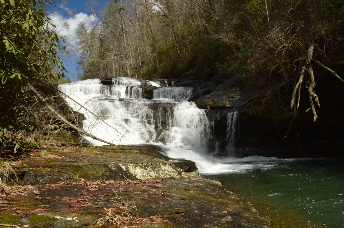
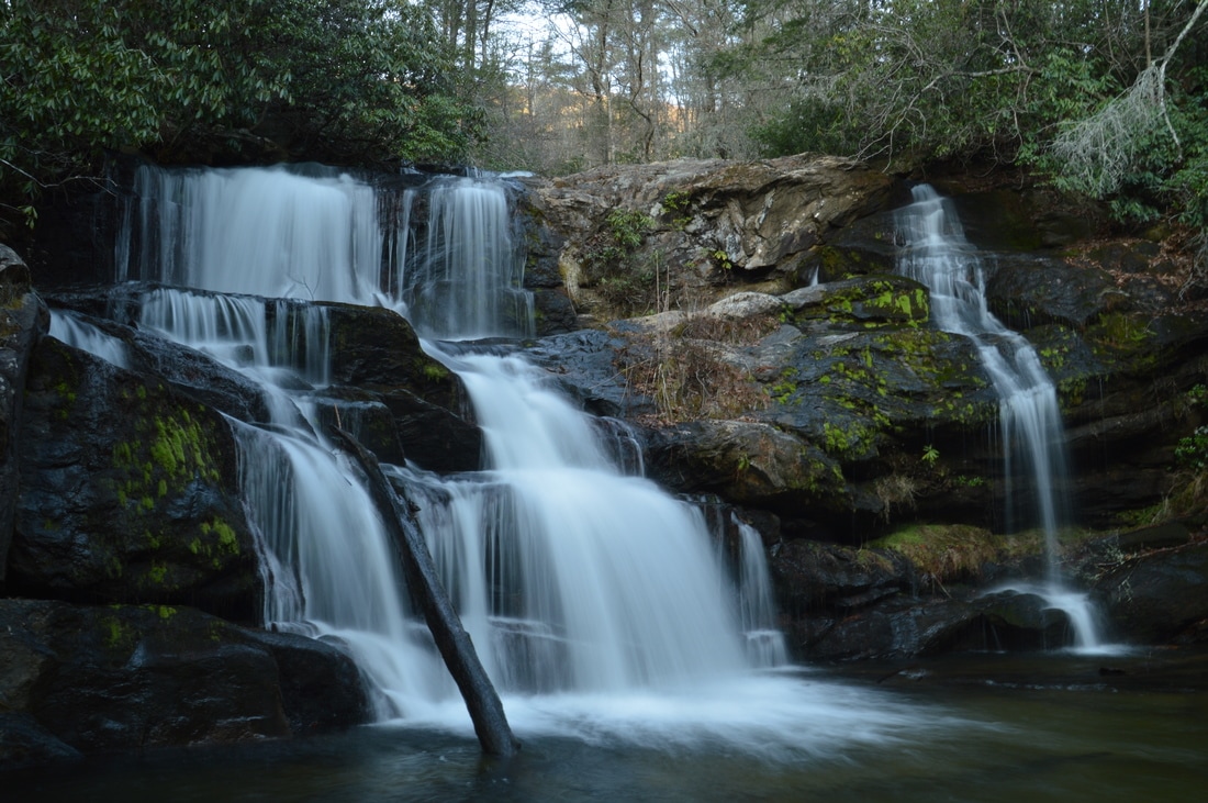
Stekoa Creek is one of the largest tributaries of the Chattooga River, flowing through the town of Clayton and the lower elevations of Rabun County. Most of the creek - including several of its notable waterfalls - is on private land. However, the lower mile and a half of Stekoa Creek flows through mostly National Forest property. In this public stretch of the creek, there are two notable waterfalls - Mill Shoals and Big Shoals - with respective heights of 27 feet and 35 feet, and getting to the waterfalls is fairly easy. Unfortunately, a headline bigger than waterfalls for Stekoa Creek is its poor water quality, due to drainage issues in Clayton. This hike occurred on Saturday, March 18th, 2017. My plan was to hike out and back from Wolf Creek Church Road to Mill Shoals and then Big Shoals on Stekoa Creek.
Deep in Rabun County is a spot known as Three Forks, where three major mountain waterways - Big Creek, Overflow Creek, and Holcomb Creek - come together to form the West Fork of the Chattooga River. Three Forks is a unique and pristine location that can only be reached by foot, but while Three Forks alone would be a hiking destination as worthwhile as any, the three creeks that tie into Three Forks are loaded with waterfalls that come in all shapes and sizes. Perhaps the most incredible one of them all is Thunder Dome Falls on Big Creek, a monster waterfall that falls 70 feet in multiple tiers through a slot canyon and into a deep pool. It can safely be assumed that Thunder Dome Falls is among Georgia's most jaw-dropping natural sights. Thunder Dome Falls is not matched in size by the other waterfalls on this hike, but even though they're smaller, all of them are just as picturesque. This hike occurred Saturday, March 11th, 2017. My plan was to hike the Big Creek Circuit clockwise from Highway 28, hiking the Big Creek Trail first and then the Three Forks Trail. Along the way, I would make side trips to each of the four waterfalls on Big Creek, to Three Forks and the Holcomb Creek slot canyon, and to Singley's Falls on Overflow Creek.

A major tributary of Big Creek, Talley Mill Creek originates just across the state line near Highlands and flows into Georgia through mostly private land. However, in the final course of its run, south of Highway 28, the creek enters National Forest land and forms a beautiful waterfall that cascades 45 feet down a steep rock ledge. The falls is surprisingly little-visited and not well-known in the hiking community, despite its proximity to the road and ease of access. In fact, an old logging road leads almost all of the way to the waterfall, and a faint path created by occasional previous hikers serves as the final leg of the hike. This hike occurred on Saturday, March 11th, 2017. My plan was to hike out and back to Talley Mill Creek Falls from Highway 28, following the route of least resistance (which turned out to be very easy to find).
The Hemlock Falls Trail is one of Georgia's most popular streamside trails, and for good reason: the trail follows beautiful Moccasin Creek, which is a constant run of whitewater nearly all of its length, culminating in Hemlock Falls, a pretty 15-foot waterfall with a pool. Above Hemlock Falls, however, lies a much less-visited world. Above Hemlock Falls, a remote and unmaintained footpath crosses the creek and continues through a picturesque gorge with many cascades and slides, before terminating at Upper Moccasin Creek Falls, a 40-foot waterfall that is widely considered to be one of Georgia's most beautiful waterfalls. This hike occurred on Saturday, March 4th, 2017. My plan was to hike the Hemlock Falls Trail and the unmaintained footpath that follows from the Moccasin Creek Trailhead to Upper Moccasin Creek Falls and back, passing Hemlock Falls on the way.
 Often, it is disappointing that some most photogenic waterfalls are located on private land. In some isolated cases, the owners are generous enough to allow the public to visit, but unfortunately, the majority of the time, such waterfalls are strictly off-limits. Timpson Creek Falls is one of those private waterfall. This single-drop 40-foot waterfall is quite a beauty. This hike occurred on Saturday, March 4th, 2017. My plan was to hike a well-established old forest road, sometimes referred to as the Timpson Creek Trail, out and back to Timpson Creek Falls from Forest Road 162 (Timpson Creek Road). This was back when I thought the entire trail from FR 162 is public land. UPDATE 9/3/2022: I have become aware that this waterfall is actually located on private land, just barely outside the National Forest. The Rabun County property tax map had previously been erroneous and had led me to believe the waterfall is publicly-accessible when it's not. Thus, I have removed the GPS coordinates for the waterfall. It may be possible to visit the waterfall with permission. If you happen to gain access, please keep in mind that 1) the short scramble path to the base of the falls is steep and slick, and 2) the owner asks to leave no trace and carry out any trash you find.
I have thus redacted the directions below. 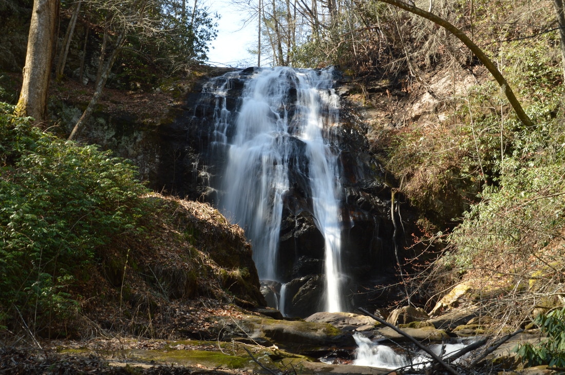
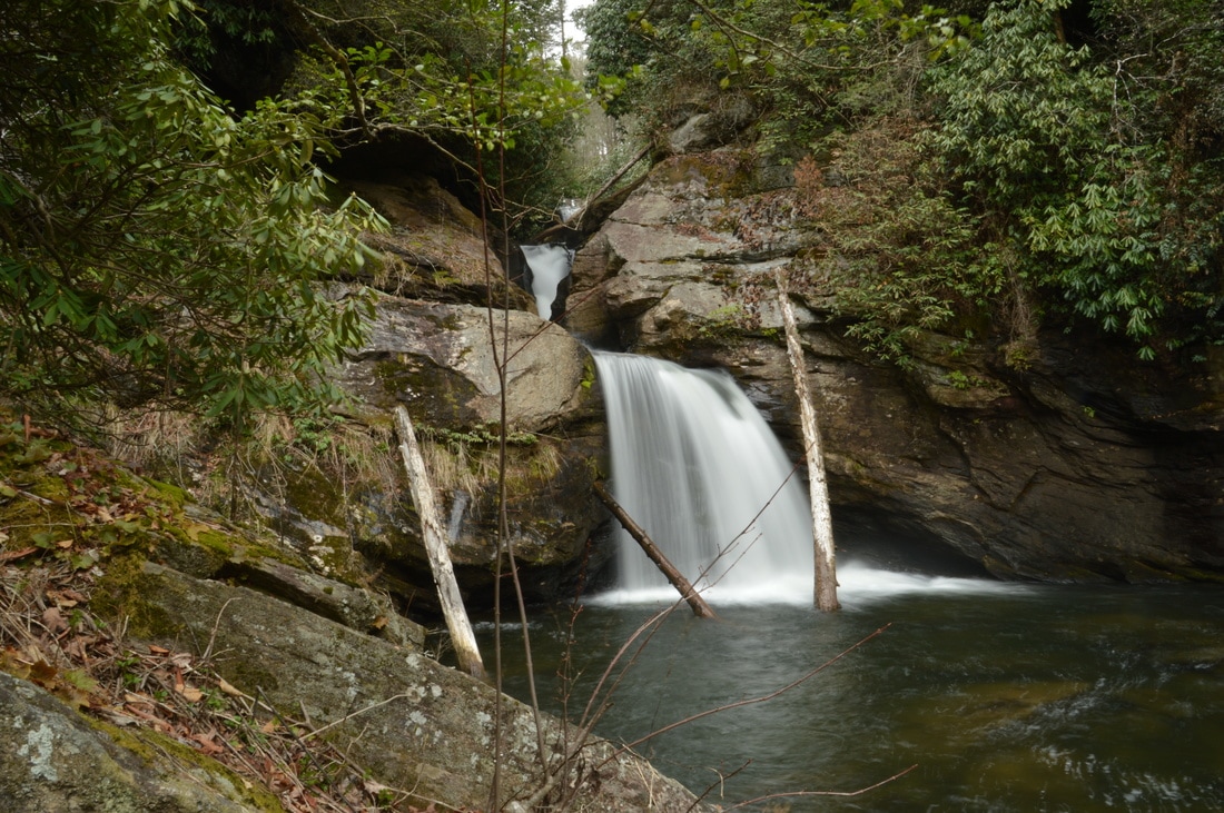
Plumorchard Creek is one of a handful of mountain streams that drain the east side of the Tennessee Valley Divide and flow into the Tallulah River. Most of these streams quickly leave the mountaintops and are already in the valleys by the time they grow large. However, Plumorchard Creek is an exception. This stream tumbles 65 feet over a single-drop waterfall that flows down a steep cliff only a mile west of the Tallulah River. This hike occurred on Saturday, March 4th, 2017. My plan was to make an exploratory bushwhack from Plum Orchard Road to a location on Plumorchard Creek that I was highly confident in being home to an undocumented tall waterfall. As it turned out, the waterfall was there, and the hike was only a partial bushwhack (the first part followed gated forest roads).
Everyone knows about Rock City. But what about Rocktown? No, Rocktown is not a miniature version of Rock City; Rocktown is an area of natural bizarre rock formations on top of Pigeon Mountain, popular with rock climbers and hikers. A network of lesser-traveled trails lies in the vicinity, providing access to Allen Creek Falls - a small but picturesque waterfall on Allen Creek - as well as winter views from Pigeon Mountain's west brow. Another such trail, Hogjowl Trail, provides a rarely-used route from McLemore Cove to the top of Pigeon Mountain. This hike occurred on Saturday, February 18th, 2017. My plan was to hike the Hogjowl Trail from west to east as the first leg of a balloon loop. Then, I would take the Bluff Trail south to Rape Gap, from where I would follow a series of forest roads to potential viewpoints of the Allen Creek Gorge (later discovering that it was not worthwhile). After this, I would return to the Atwood Trail and follow it to Allen Creek Falls, after which I would take the Hood Trail and then a short connector trail to Rocktown. I would follow the Rocktown Trail from Rocktown out to the Rocktown Trailhead. Following a brief roadwalk to Sawmill Lake, I would pick up the Hogjowl Trail and hike it west back to McLemore Cove.
The Chattahoochee National Forest is home to many waterfalls. Some require long hikes on faint trails or trail-less woods to reach; others can be accessed by short, easy paths. The two waterfalls on Helton Creek fall into the latter category, as very little effort is needed to see these two impressive waterfalls. The groomed path to the waterfalls is well-established, with staircases and an observation deck. Keep in mind that during the hot season, the ease of access - along with the perfect swimming hole at the falls - leads to great crowds. This hike occurred on Saturday, February 11th, 2017. My plan was to hike the Helton Creek Falls Trail out and back to the upper waterfall on Helton Creek, with a short side trip to the lower waterfall on Helton Creek along the way.
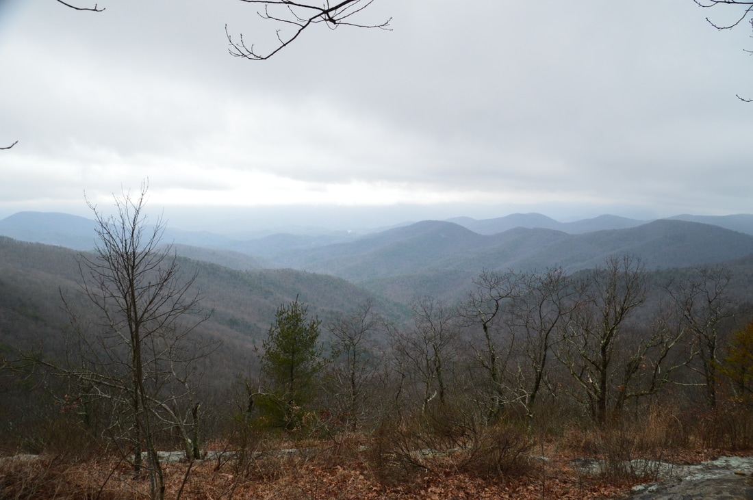
One of Georgia's most scenic hikes is along the Appalachian Trail from Neels Gap to Hogpen Gap. Along this section of the AT, the famed long-distance footpath passes over several summits that offer outstanding long-range vistas. Along the way, you will first walk along the only piece of the AT that passes under a building, at the Walasi-Yi Interpretive Center. Afterwards, you will hike across Levelland Mountain, Wolf Laurel Top, Cowrock Mountain, and Wildcat Mountain, each of which has its own breathtaking view (or several). This hike occurred on Saturday, February 11th, 2017. My plan was to hike the Byron Herbert Reece Trail from US 129 to the Appalachian Trail. There, I would pick up the Appalachian Trail and follow it through Neels Gap and to Hogpen Gap. Along the way, I would make side trips to views on Levelland Mountain and Cowrock Mountain. I arranged to have two cars for this point-to-point hike: one car was placed at the Byron Herbert Reece Trailhead and another car was placed at the Hogpen Gap Trailhead.
Chattahoochee National Forest: Long Branch Trail and Green Mountain Trail, Blue Ridge, Georgia3/7/2017 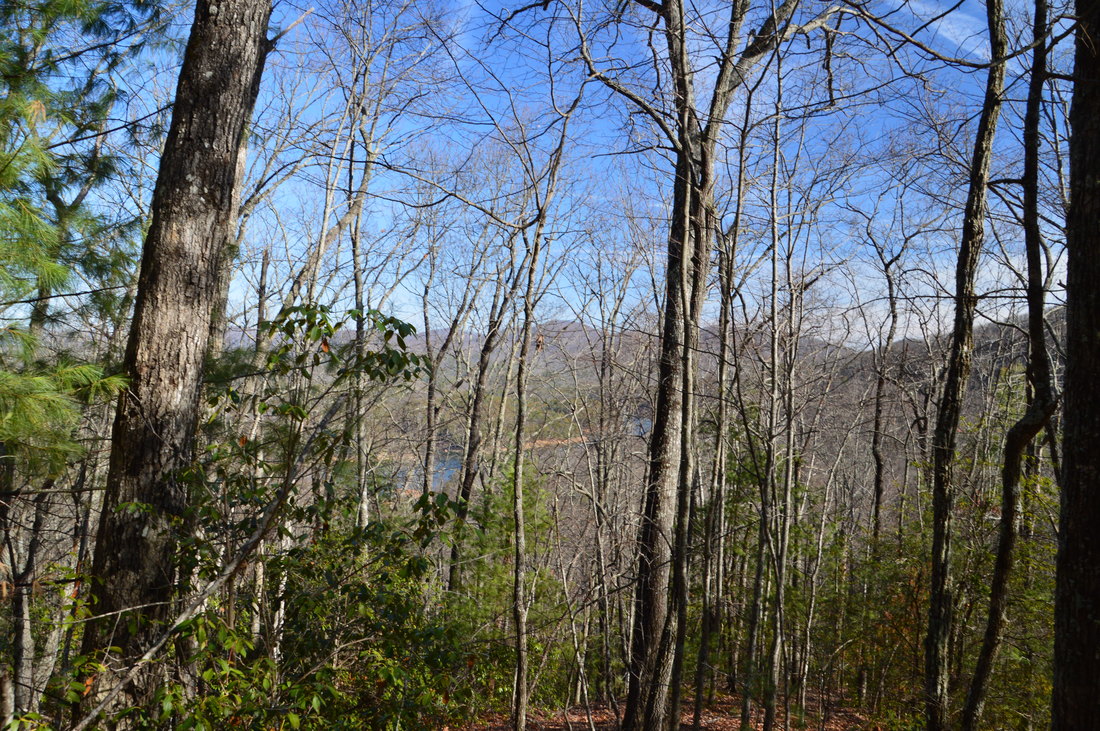
The Blue Ridge area is not known for hiking trails as well as other parts of north Georgia, due to the heavy development of the area (Blue Ridge has become a popular getaway for folks who own a second home in the area but live most of the time outside of the mountains). The Aska Trail System near Blue Ridge has the longest interconnected set of trails in the region, and in fact, these trails are open to bikers in addition to hikers. The Aska Trails meander across the slopes of Rocky Mountain, Davenport Mountain, and Green Mountain, providing good views when the leaves are off the trees. One of the trails also provides access to the shoreline of 3300-acre Lake Blue Ridge. This hike occurred on Saturday, February 4th, 2017. My plan was to hike the east side of the Long Branch Loop Trail and then the Long Branch Connector Trail to the Green Mountain Trail. From there, I would first hike the Green Mountain Trail east out and back to the Lake Blue Ridge Trailhead, and then, I would hike the Green Mountain Trail west to Deep Gap, looping it with the Lower Green Mountain Trail. I would conclude the hike by retracing my steps along the Long Branch Connector and following the west side of the Long Branch Loop.
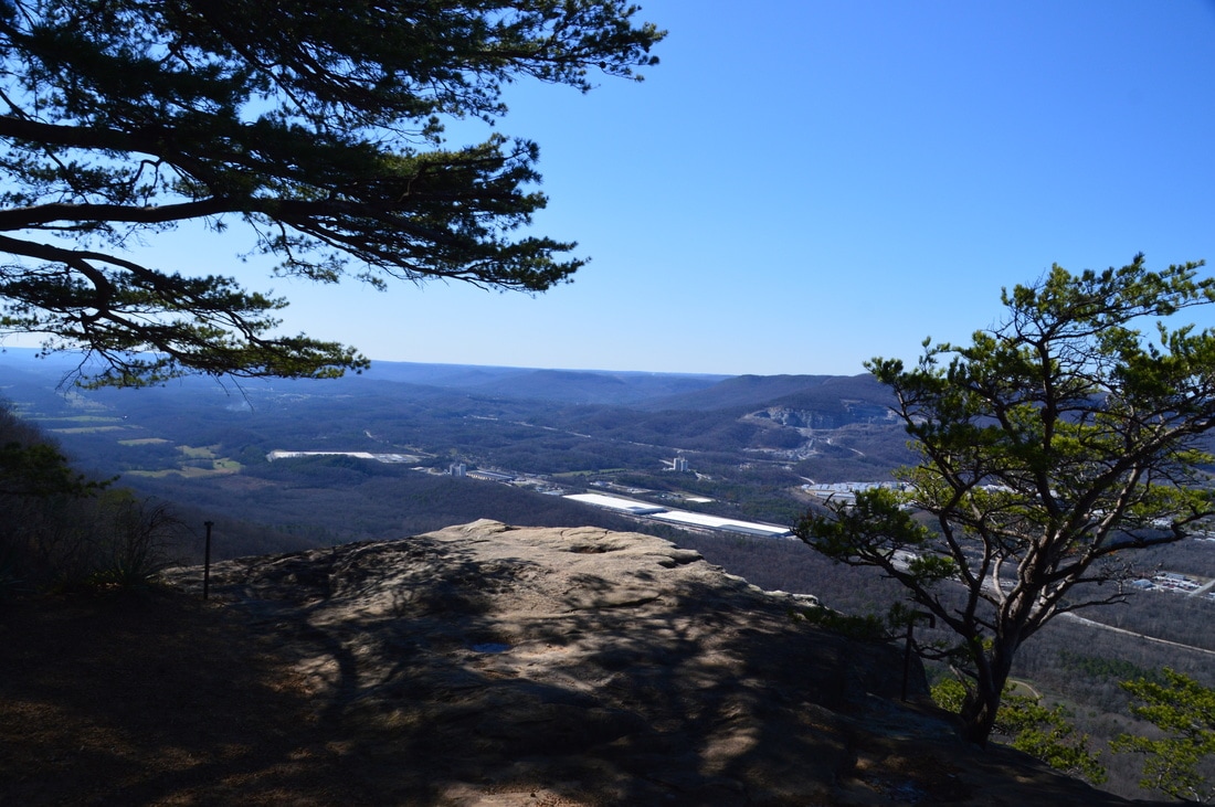
Lookout Mountain Battlefield, which is part of the Chickamauga & Chattanooga National Military Park, covers an impressive portion of Lookout Mountain, where the "Battle Above the Clouds" occurred during the Civil War. The battlefield's extensive trail system provides easy access to some of the mountain's signature features, such as Sunset Rock and Point Park, both of which have panoramic vistas. The park's most scenic trail, Bluff Trail, follows the bluff line along the west side of Lookout Mountain for several miles, connecting to other trails with more views and other points of interest such as mountain springs. This hike occurred on Saturday, January 28th, 2017. My plan was to hike the Bluff Trail from Ochs Gateway to Point Park. Along the way, I would take a side trip along the Jackson Gap Trail and also to Sunset Rock. From Point Park, I would follow the Mountain Beautiful Trail and Hardy Trail to Cravens House, from where I would take the Rifle Pits Trail to the Upper Truck Trail. Then, I would hike along the Upper Truck Trail past the ruins of Camp Demaray to the Gum Spring Trail. Lastly, I would follow the Gum Spring Trail up to the Bluff Trail, concluding the hike by retracing my steps on a portion of my earlier route along the Bluff Trail.
Chattahoochee National Forest: Canada Creek Falls, Ontario Falls, and Alberta Falls, Suches, Georgia2/28/2017 
Folks who reside in the north Georgia Mountains are familiar with Woody Lake, a picturesque pond next to Route 60 in the community of Suches. What many of the locals are not familiar with, however, is that the stream that drains Woody Lake drops over four notable waterfalls and through a scenic gorge on its way to the Toccoa River. Three of the waterfalls can be accessed from a trailhead at the end of East Canada Creek Road, at a place where shrinking fields and old silos illustrate that a farm once prospered here. While no official trail leads to any of the waterfalls, getting to them presents only a minor navigational challenge along a series of forest roads and narrow paths worn by fellow hikers. This hike occurred on Saturday, January 21st, 2017. My plan was first to hike from the end of East Canada Creek Road downstream along Canada Creek to Ontario Falls and Canada Creek Falls. Then, I would retrace my steps and follow the creek upstream to Alberta Falls. I would save the hike to Yukon Falls for another day.
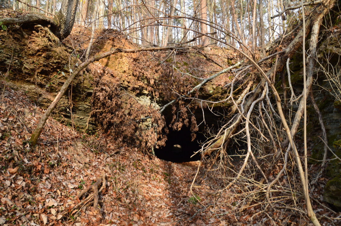
Ellison's Cave is one of the most famous caves in the US, and for good reason: the cave has the deepest unobstructed underground pitch - the Fantastic Pit - in continental US. While navigating through the over 12-mile long cave requires serious training, skills, and lots of caving equipment, the entrance to the cave can simply be viewed from a hiking trail. Ellison's Cave is just one of Pigeon Mountain's many unique highlights. Another such highlight is the Estelle Mines and Tunnels. Iron ore was mined on the northwestern side of the base of Pigeon Mountain and was transported by rail through six tunnels to the former mining town of Estelle. Operations at the site ceased in 1924, and today, all that remains are some ruins of the town of Estelle and the railroad tunnels. While some of the tunnels have caved in, others are intact and can even be walked through. On this hike, you'll visit both Ellison's Cave and the Estelle Mines, each of which would be a worthwhile destination even by itself. This hike occurred on Saturday, January 14th, 2017. My plan was to hike the Blue Hole Trail from Blue Hole past both the dug entrance and historic entrance of Ellison's Cave to the top of Pigeon Mountain. From there, I would hike the Estelle Mines Loop (a combination of Pocket Trail, Estelle Mines Trail, Bluebird Gap Shortcut, and Bluff Trail) clockwise, passing Pocket Falls and all of the Estelle Mines railroad tunnels.
|
About MeMark Oleg Ozboyd Dear readers: I have invested a tremendous amount of time and effort in this website and the Georgia Waterfalls Database the past five years. All of the work that has gone in keeping these websites updated with my latest trip reports has almost been like a full-time job. This has not allowed me to pick up a paid job to save up money for college, and therefore, I I've had to take out loans. If you find the information on this website interesting, helpful, or time-saving, you can say "thanks" and help me out by clicking the button above and making a contribution. I will be very grateful for any amount of support you give, as all of it will apply toward my college tuition. Thank you!

Coming in 2022-2023?
Other Hiking WebsitesMiles HikedYear 1: 540.0 Miles
Year 2: 552.3 Miles Year 3: 518.4 Miles Year 4: 482.4 Miles Year 5: 259.9 Miles Archives
March 2021
Categories
All
|
 RSS Feed