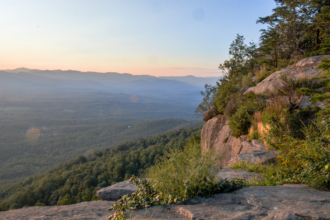
Few mountains in Georgia are landmarks as prominent as Yonah Mountain. Situated between the towns of Helen and Cleveland, Yonah Mountain's shape and spectacular sheer cliffs can be recognized from nearly every direction. In recent years, the trail to the top of Yonah Mountain has also become one of the most popular hikes in Georgia and for good reason: the incredible panoramic views atop Yonah's cliffs are easily among Georgia's most breathtaking. Even though the trail involves a fairly steep ascent, it does not stop up to hundreds of people from visiting the cliffs on good weekends. Unfortunately, the crowds can be a drawback of this hike, but the views are so spectacular that it's still worth it, and if you hike very early in the morning or late in the day, you might encounter relatively few people. This hike occurred on Monday, September 4th, 2017. My plan was to hike the Yonah Mountain Trail out and back to the top of Yonah Mountain, where I would make a small loop visiting all four main vistas. On my way back, I would make a slight detour to see an enormous boulder known simply as "The Boulder".
1 Comment
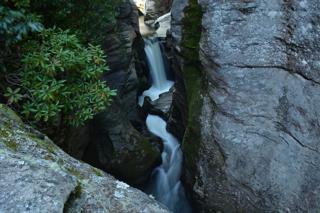
The Whitewater River is one of the most spectacular rivers in the Southeastern US. In its 15-mile length, the river plummets over two of the region's tallest and most breathtaking waterfalls, through a rare narrow slot canyon, and over nearly a dozen smaller waterfalls. Most folks familiar with the Whitewater River only know about Upper & Lower Whitewater Falls. This report focuses on the area immediately upstream, known as the Upper Whitewater River area, which is one of the most rugged, pristine, and gorgeous stretches of river that I've hiked. The Upper Whitewater Slot Canyon is a particularly unique location, where the mighty Whitewater River squeezes into a narrow canyon about 300 feet long and only a feet wide, lined by sheer cliffs rising dozens of feet. The river even crashes over two significant waterfalls - Sculpted Falls & Little Canyon Falls - in the canyon, as well as two others - Entrance Falls and Exit Falls - at both ends of it. While the waterfalls around the canyon are this hike's biggest highlight, many other photogenic waterfalls such as 55 MPH Falls lie between the canyon and Route 281, and the scenic Hornet Falls on Democrat Creek, a Whitewater River tributary, is a great bonus too. Seeing all of the waterfalls along the Upper Whitewater River requires a cross-country trek about as challenging as any in the North Carolina mountains, although access to a few selected waterfalls by themselves is easier. This hike occurred on Saturday, September 9th, 2017. Placing one car at NC 281 and another on Heady Mountain Road, my plan was to follow the easiest route downstream along the Whitewater River between the two parking areas, making sure to visit all waterfalls on the river as well as Hornet Falls on Democrat Creek.
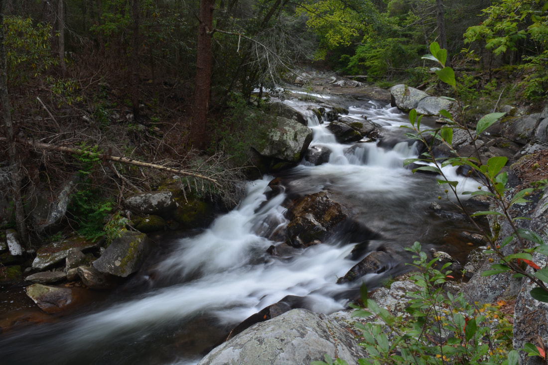
The beauty of the Conasauga River's rushing waters attracts many hikers and campers to the west side of the Cohutta Wilderness. Every single trail in this part of the wilderness crosses and follows the Conasauga at some point, but no other trail is as notable as the Conasauga River Trail. This trail follows its namesake river for nearly a dozen miles, as it gradually grows from a small rivulet at the headwaters area near Betty Gap to a wide boulder-strewn river lined by cliffs and full of swift rapids below the confluences of Rough Creek, Thomas Creek, and Hickory Creek. A whopping 38 fords of the Conasauga River - some of which are up to waist-deep - make this a fairly challenging aqua-hike, but those who choose to shuttle the full trail will be rewarded by countless scenic cascades and small waterfalls. An out-and-back hike from either end of the trail is worthwhile as well, as beautiful water features are scattered evenly throughout the river. This hike occurred on Saturday, September 2nd, 2017. My plan was to hike the Conasauga River Trail from its southern trailhead at Betty Gap on FS 64 to its northern trailhead at FS 17B. I arranged to have two cars for this point-to-point hike: one at FS 64 and the other at FS 17B.
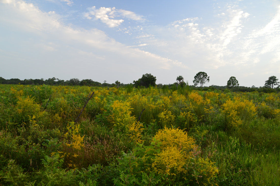
Nestled near the west Florida coastline between Sarasota and Venice, the underrated Oscar Scherer State Park is a haven for folks looking for a peaceful day hike in this part of southwest Florida. The park is known best as the home of the last remaining scrub jay habitat in southwest Florida, but it also has a superb color-coded trail system that introduces hikers to South Creek and its hammocks as well as the scrub and flatwoods nearby. In particular, the diverse Yellow Trail - part of the park's North Trail System - passes through a large range of ecosystems, crossing South Creek twice, passing a beautiful lake known as Big Lake, and travelling through a large section of the scrub. Hikers will even be able to see an old railroad trestle across South Creek. Thanks to its range of scenery and points of interest, the Yellow Trail at Oscar Scherer State Park has quickly turned into one of my favorite hikes in Southwest Florida. This hike occurred on Wednesday, August 2nd, 2017. My plan was to hike the Yellow Loop Trail counter-clockwise with a short detour to the Big Lake observation platform.
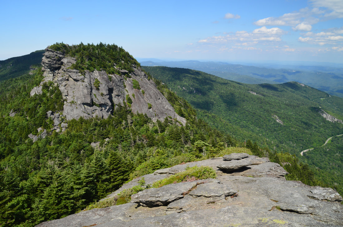
Anyone who lives in the Southeastern United States must have a hike along the crest of Grandfather Mountain on their bucket list. No words or pictures can accurately describe or convey the rugged splendor of the Grandfather Crest. Part of Grandfather Mountain is still operated as a private attraction that does allow public access under a hefty fee and a number of restrictions, but most of the mountain is land owned by the state of North Carolina in the form of Grandfather Mountain State Park. One of the secondary trailheads for Grandfather Mountain is actually off the Blue Ridge Parkway, from which several trails lead to Calloway Peak - the highest point on Grandfather Mountain. From there, the Grandfather Trail makes a very rugged traverse over two other peaks - Attic Window Peak and MacRae Peak - with many technical rock scrambles, cable sections, ladders, and of course, outstanding views. The 360-degree vistas on Attic Window Peak and MacRae Peak are of the type that you would find in Montana or Colorado rather than North Carolina. Eventually, the Grandfather Trail descends into the mountain's private section, reaching Linville Peak (where additional views await) and one of North Carolina's best-known tourist attractions: the Mile-High Swinging Bridge. This hike occurred on Monday, July 10th, 2017. My plan was to hike the Tanawha Trail, Nuwati Trail, Cragway Trail, and Daniel Boone Scout Trail to the summit of Calloway Peak, passing Top Crag View, Flat Rock View, Lynn Cove Viaduct View, and an old plane crash. Then, I would follow the Grandfather Trail over Attic Window Peak and MacRae Peak to Linville Peak and the Swinging Bridge, making side trips to Watauga View and Indian House Cave along the way. My return route would be similar, but I would use the Underwood Trail to bypass MacRae Peak, and I would use only the Daniel Boone Scout Trail instead of the Cragway Trail and Nuwati Trail for a slightly easier descent back to the trailhead from Calloway Peak. This hike was the ninth of ten hikes that I did during a seven-day trip to the mountains of northwest North Carolina.
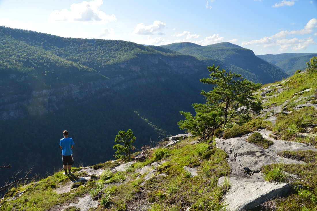
If I had to name the ten best hikes that I have ever done, the hike along the east rim of Linville Gorge to Table Rock and the North Carolina Wall would make the list without question. This section of the Mountains-to-Sea Trail provides access to several jaw-dropping vistas of Linville Gorge as well as its surroundings. North of the Table Rock Picnic Area is the summit of Table Rock, whose lofty peak is surrounded by cliffs hundreds of feet high and whose elongated rocky summit is home to a series of grand vistas that encompass a 360-degree view. Meanwhile, to the south, the MST first passes through a place called The Chimneys, a series of wild and jagged rock outcrops of all shapes and sizes, where the knife-edge ridge with 360-degree views forms a boundary between the rolling hills of the North Carolina Piedmont and the ruggedness of Linville Gorge. Then, if all of that wasn't enough, a pair of side trails lead to the North Carolina Wall. Rising hundreds of feet high, the North Carolina Wall is an incredible line of cliffs with continuous views over a half-mile long along the east rim of the gorge. This hike occurred on Friday, July 7th, 2017. My plan was to hike the Mountains-to-Sea Trail and Table Rock Trail from the Table Rock Picnic Area to the summit of Table Rock. On my way back, I would take a side trail to an area of cliffs known as the Devil's Cellar. Then, I would follow the Mountains-to-Sea Trail in the other direction to and through The Chimneys, before taking a side trail down to an area on the rim of the gorge known as The Amphitheater. Finally, I would follow another faint trail along the top of the NC Wall back to the MST, before retracing my steps back to the picnic area. This hike was the sixth of ten hikes that I did during a seven-day trip to the mountains of northwest North Carolina.
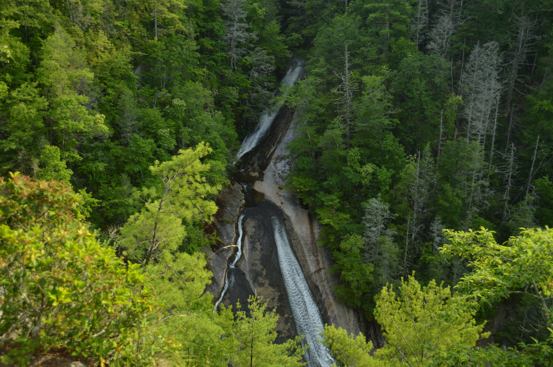
The Wilson Creek watershed in the Grandfather Ranger District of Pisgah National Forest is well-known for its numerous hiking trails and backpacking opportunities. One of the largest tributaries of Wilson Creek is Harper Creek. Harper Creek and its tributaries are home to several spectacular waterfalls in the shadow of Grandfather Mountain. Particularly impressive is South Harper Creek Falls: a massive 120-foot double sliding waterfall that can be viewed from three distinct locations: the base, the midpoint, and the cliffs on the other side of Harper Creek. If you hike the Harper Creek Loop, you'll also pass triple-tier Harper Creek Falls - that isn't too shabby either - and have the option to take a lengthy side trail to Bard Falls on North Harper Creek. However, it is best to be prepared for overgrown trails and over a dozen wet crossings of Harper Creek if you do hike the full loop. This hike occurred on Thursday, July 6th, 2017. My plan was to hike the Harper Creek Loop counter-clockwise from Brown Mountain Beach Road, following the Harper Creek Trail and then the Raider Camp Trail. Along the way, I would take a side trip to Bard Falls along the North Harper Creek Trail, and I would also take short side trails to Harper Creek Falls and three different viewpoints for South Harper Creek Falls. This hike was the fourth of ten hikes that I did during a seven-day trip to the mountains of northwest North Carolina.
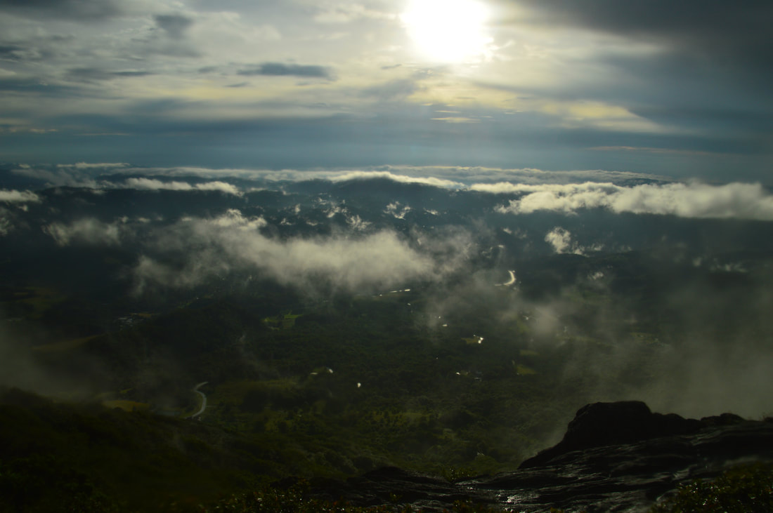 The Snake Mountain Trail easily makes the list for the top 5 best mountain hikes in North Carolina. Located in the Elk Knob Game Lands, the Snake Mountain ridge sports spectacular views in all directions from a trail that follows the very knife-edge crest of the ridge, passing over many rock outcrops and sometimes traveling mere inches from the edges of cliffs dozens of feet high. The hike to Snake Mountain is not for the average hiker due to the extremely steep ascent and the numerous technical scrambles along the ridge, but those who make it will be rewarded with some of the best views anywhere in the Southeast. The Sunalei Preserve and its homeowners must be commended for their willingness to allow public travel through the private property that the first part of the trail passes. This hike occurred on Wednesday, July 5th, 2017. My plan was to hike out and back along the Snake Mountain Trail over the North Peak and South Peak of Snake Mountain from the north trailhead off Meat Camp Road. Unfortunately, rain and fog ruined some of the views, but it still turned out to be a spectacular hike. This hike was the third of ten hikes that I did during a seven-day trip to the mountains of northwest North Carolina. Update #5 1/3/18: Unfortunately, hiking the Snake Mountain Trail is currently no longer legal. The property owners have gated the parking lot, placed purple paint alongside the road by the trailhead, and mentioned that hiking the trail right now is trespassing. At this time, the owners do not want people hiking the trail due to all the litter that has been left behind. I have chosen to hide the Snake Mountain trail guide on this page for the time being, out of respect for the owners' wishes. Should the access situation change, you'll hear it from me first. Let's keep our fingers crossed that this amazing piece of land may receive a conservation easement or be purchased by a conservancy sometime in the future.
The mountains in the vicinity of Jasper are known more for their private residential communities and vacation homes than for their secluded hiking trails. It's not surprising, as most of the Mount Oglethorpe vicinity is developed heavily. There is an exception though: on the east side of Mount Oglethorpe is a 4500-acre tract of land that is part of Dawson Forest Wildlife Management Area and is owned by the state. Known as the Wildcat Tract, it is home to at least five waterfalls that are up to 80 feet high. A superb trail system with two trailheads was developed throughout the Wildcat Tract, facilitating access to the waterfalls and providing a number of options for day hikes/loops with various lengths. This hike occurred on Saturday, June 17th, 2017. My plan was to hike the outer Wildcat Creek Loop counter-clockwise from the Wildcat Campground. First, I would hike the Wildcat Creek Trail and Fall Creek Trail, taking side trails to four waterfalls on Fall Creek. At the end of the Fall Creek Trail, I would follow the Tobacco Pouch Trail and then Rocky Ford Trail back into the valley, visiting Rocky Ford Falls along the way. I would conclude the hike along the Turner Trail.
A classic Southern Appalachian wilderness hike, the Beech Creek Loop is a 'must-do' for all classes of hikers alike. I'll add that the Beech Creek Loop is among the top hikes that I have ever done, in Georgia or elsewhere. Over its eight-mile course, the loop visits two spectacular waterfalls - one of which is about 100 feet high - and passes a lengthy but worthwhile side trail to a breathtaking 180-degree view from Big Scaly Mountain into the Tallulah River Valley. In addition, the trail provides a perfect wilderness experience, full of solitude all throughout the Beech Creek gorge and on the slopes of Big Scaly Mountain. A short stretch of roadwalk is necessary to close the loop, but even walking along Tallulah River Road is nice, as you will get several views of the Tallulah River and its cascades. This hike occurred on Saturday, June 10th, 2017. My plan was to hike the Beech Creek Loop counter-clockwise, although I would use two cars to eliminate the 1.2-mile roadwalk. Along the way, I would take short side trips to Bull Cove Falls and High Falls and a much longer side trip to the vista on Big Scaly Mountain. Note that if you do the Beech Creek Loop, you must by all means take the time to go to the overlook as well.
Today nearly a ghost town, Tate City once was a prospering town centered around the logging business and the mining of corundum. A handful of folks live in Tate City through the year, but many houses in this quaint community are simply second homes. The pleasant drive through Tate City leads to a door into the Southern Nantahala Wilderness, a land of many top-tier waterfalls. The hike along the unofficial but well-defined Denton Creek Trail should be at the top of any waterfall hunter's list. In an easy to moderate two miles, folks who hike the Denton Creek Trail will visit three pristine waterfalls. Particularly attractive is Lower Denton Creek Falls, a free-fall waterfall that tumbles 40 feet over a sheer cliff speckled with lush green vegetation. In addition, hikers will be treated to continuous streamside scenery all throughout the Denton Creek Trail. This hike occurred on Saturday, June 10th, 2017. My plan was to hike out and back along the Denton Creek Trail to Upper Denton Creek Falls. Along the way, I would take the side trail to Lower Denton Creek Falls, and I would also make the short off-trail scramble down to Middle Denton Creek Falls.
Three thousand feet of elevation gain on a hike in the mountains is fairly common; three thousand feet of elevation gain on a hike in Florida is unheard of. Florida is well-known for its flat terrain, but exceptions do exist. Located on the east side of the Apalachicola River in the middle of nowhere, Torreya State Park - one of Florida's most interesting natural areas - features dozens of steephead ravines, limestone bluffs, sharp hills, and even a waterfall. In fact, it is safe to say that the park's hiking trails are the most rugged in Florida. Torreya State Park also boasts a collection of rare plants and animals, including the extremely rare Florida torreya tree, that are not typically found this far south. You'll get quite a workout on this hike, ascending dozens of hills and visiting many scenic mini-canyons carved out by small streams that feed the Apalachicola River. Also, you'll view the Apalachicola River from blufftop overlooks in several places. This hike occurred on Sunday, April 16th, 2017. My plan was to hike the Torreya Loop Trail counter-clockwise starting via the Gregory House east access trail. Along the way, I would make side trips to Weeping Ridge Falls and to Rock Bluff Overlook, and additionally, I would hike the Rock Creek Loop counter-clockwise.
Chattahoochee National Forest: Darnell Creek Loop Trail to Ramey Creek Falls, Dillard, Georgia5/1/2017 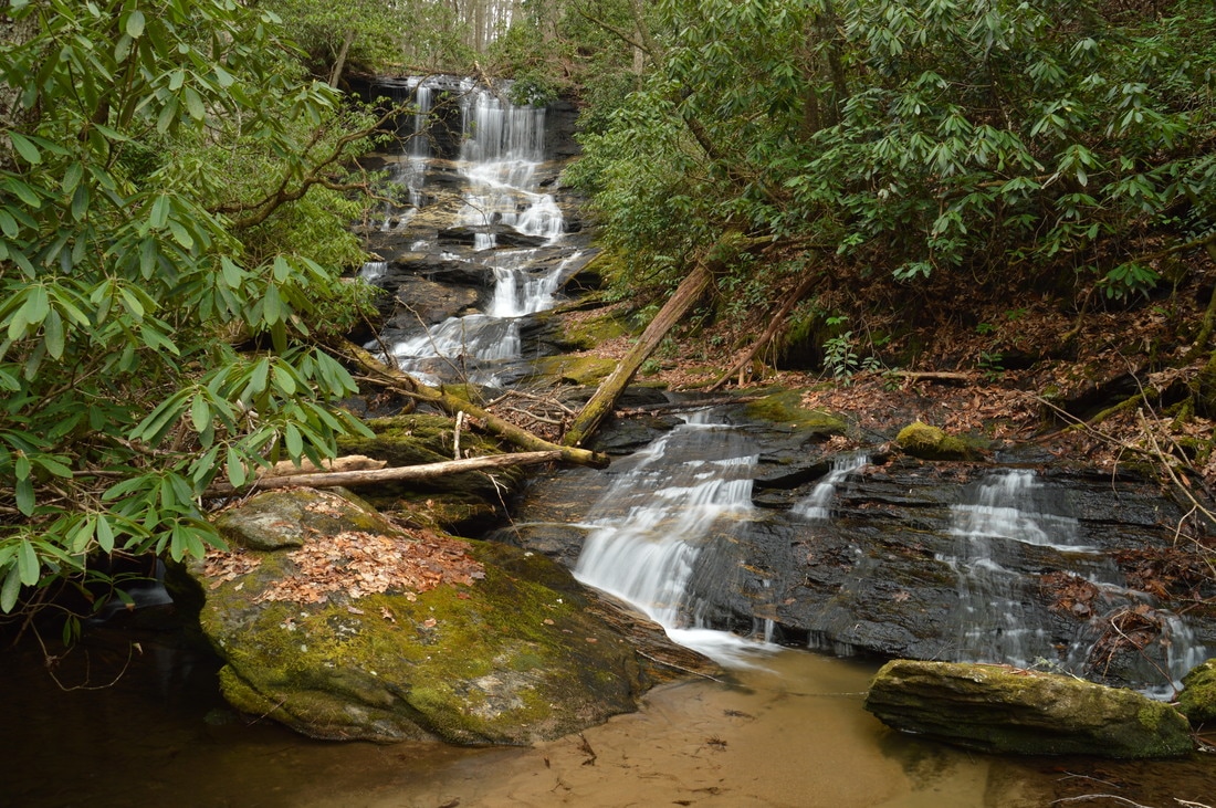
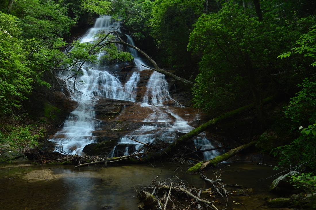
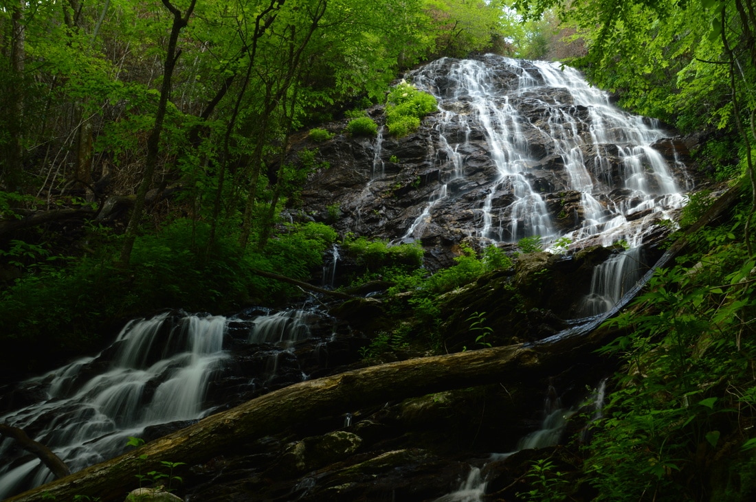
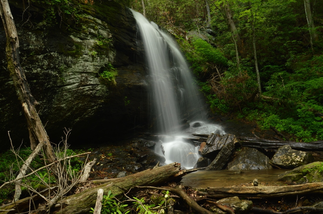
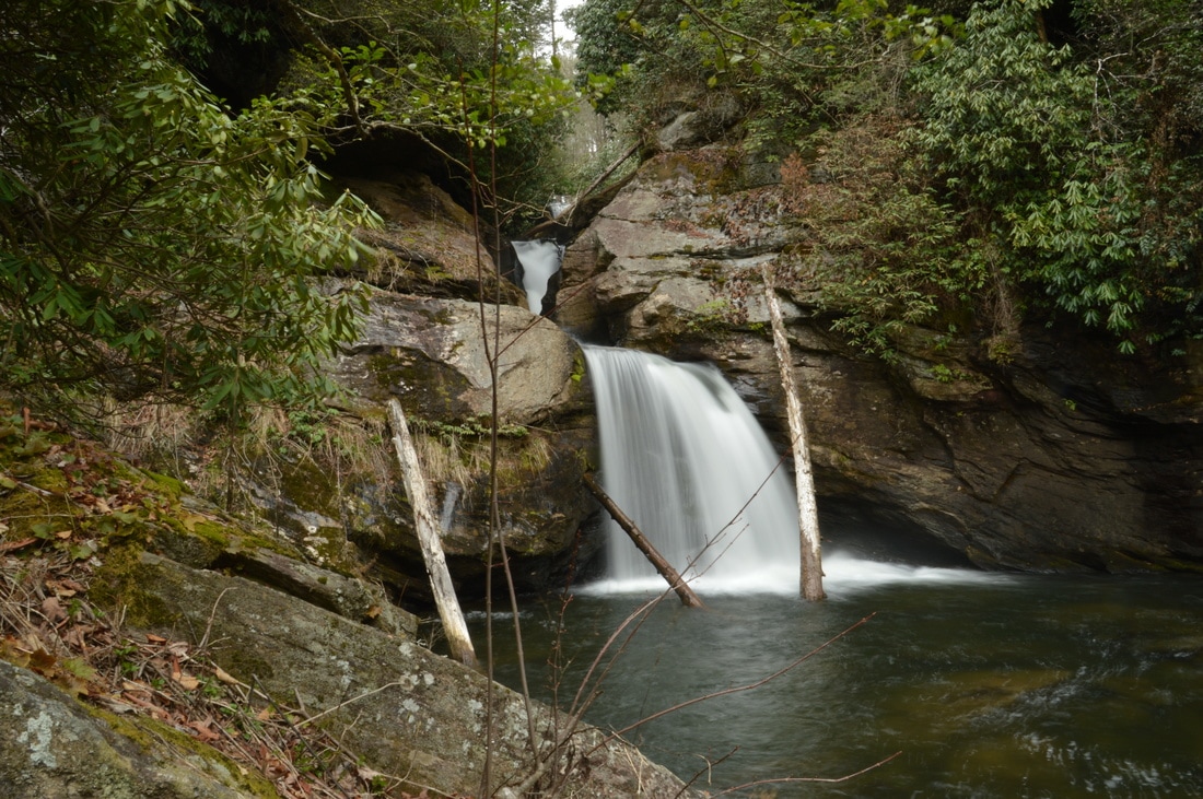
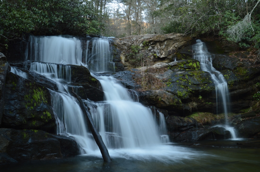
The Darnell Creek area is known for its abundance of notable waterfalls. All of the waterfalls on Darnell Creek and Thomas Creek - one of its two headwater tributaries - are close to Darnell Creek Road and are reached via short and easy hikes. But what about Darnell Creek's other headwater tributary, Ramey Creek? This creek, which is in no way less scenic than Thomas Creek, flows considerably further south and is reached by the Darnell Creek Trail: a well-established trail that first follows Darnell Creek and then Ramey Creek. The Darnell Creek Trail's biggest highlight is a 45-foot waterfall on Ramey Creek. Situated at the head of a narrow gorge, Ramey Creek Falls is a photogenic waterfall featuring a cliff over which the waterfall initially plunges, followed by a series of cascades down a number of rock outcrops. Taking the waterfall aside though, the Darnell Creek Trail is still a very pretty trail that passes numerous cascades and small waterfalls on Darnell Creek and Ramey Creek, in addition to a panoramic wintertime view of the grand 100-foot Big Falls on Thomas Creek in the distance across the valley. This hike occurred on Saturday, March 25th, 2017. My plan was to hike the Darnell Creek Trail to Ramey Creek Falls. From Ramey Creek Falls, I would add variety to my hike by hiking the TR 61A Loop (Darnell Creek Loop), rejoining the Darnell Creek Trail at Pine Gap Branch and retracing my steps the rest of the way to the trailhead.
Deep in Rabun County is a spot known as Three Forks, where three major mountain waterways - Big Creek, Overflow Creek, and Holcomb Creek - come together to form the West Fork of the Chattooga River. Three Forks is a unique and pristine location that can only be reached by foot, but while Three Forks alone would be a hiking destination as worthwhile as any, the three creeks that tie into Three Forks are loaded with waterfalls that come in all shapes and sizes. Perhaps the most incredible one of them all is Thunder Dome Falls on Big Creek, a monster waterfall that falls 70 feet in multiple tiers through a slot canyon and into a deep pool. It can safely be assumed that Thunder Dome Falls is among Georgia's most jaw-dropping natural sights. Thunder Dome Falls is not matched in size by the other waterfalls on this hike, but even though they're smaller, all of them are just as picturesque. This hike occurred Saturday, March 11th, 2017. My plan was to hike the Big Creek Circuit clockwise from Highway 28, hiking the Big Creek Trail first and then the Three Forks Trail. Along the way, I would make side trips to each of the four waterfalls on Big Creek, to Three Forks and the Holcomb Creek slot canyon, and to Singley's Falls on Overflow Creek.
The Hemlock Falls Trail is one of Georgia's most popular streamside trails, and for good reason: the trail follows beautiful Moccasin Creek, which is a constant run of whitewater nearly all of its length, culminating in Hemlock Falls, a pretty 15-foot waterfall with a pool. Above Hemlock Falls, however, lies a much less-visited world. Above Hemlock Falls, a remote and unmaintained footpath crosses the creek and continues through a picturesque gorge with many cascades and slides, before terminating at Upper Moccasin Creek Falls, a 40-foot waterfall that is widely considered to be one of Georgia's most beautiful waterfalls. This hike occurred on Saturday, March 4th, 2017. My plan was to hike the Hemlock Falls Trail and the unmaintained footpath that follows from the Moccasin Creek Trailhead to Upper Moccasin Creek Falls and back, passing Hemlock Falls on the way.
|
About MeMark Oleg Ozboyd Dear readers: I have invested a tremendous amount of time and effort in this website and the Georgia Waterfalls Database the past five years. All of the work that has gone in keeping these websites updated with my latest trip reports has almost been like a full-time job. This has not allowed me to pick up a paid job to save up money for college, and therefore, I I've had to take out loans. If you find the information on this website interesting, helpful, or time-saving, you can say "thanks" and help me out by clicking the button above and making a contribution. I will be very grateful for any amount of support you give, as all of it will apply toward my college tuition. Thank you!

Coming in 2022-2023?
Other Hiking WebsitesMiles HikedYear 1: 540.0 Miles
Year 2: 552.3 Miles Year 3: 518.4 Miles Year 4: 482.4 Miles Year 5: 259.9 Miles Archives
March 2021
Categories
All
|
 RSS Feed